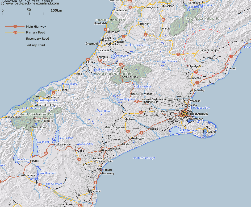
Map showing location of One Tree Saddle


LINZ description: Saddle south-east of Mt Paul and west of One Tree Hill
Latitude: -42.562533
Longitude: 172.972952
Northing: 5287762.9
Easting: 1597779.8
Land District: Canterbury
Feat Type: Pass


Scroll down to see a more detailed road map and below that a topographical map showing the location of One Tree Saddle. The road map has been supplied by openstreetmap and the topographical map of One Tree Saddle has been supplied by Land Information New Zealand (LINZ).

Yes you can use the top static map for you school/university project or personal website with a link back. Contact me for any commercial use.

One Tree Saddle Map New Zealand


New Zealand places in our database
[ A ] [ B ] [ C ] [ D ] [ E ] [ F ] [ G ] [ H ] [ I ] [ J ] [ K ] [ L ] [ M ] [ N ] [ O ] [ P ] [ Q ] [ R ] [ S ] [ T ] [ U ] [ V ] [ W ] [ X ] [ Y ] [ Z ]


Closest 20 Passs to One Tree Saddle

Lyndon Pass ( 4.13km )   Jollies Pass ( 10.79km )   Leslie Pass ( 12.27km )   Hossack Saddle ( 12.93km )   Jacks Pass ( 15.12km )   Whales Back Saddle ( 20.4km )   Pahau Pass ( 22.95km )   Peters Pass ( 25.04km )   Collins Saddle ( 25.18km )   Edwards Pass ( 25.31km )   Five Mile Saddle ( 25.45km )   Yarra Saddle ( 28.78km )   Palmer Saddle ( 31.84km )   Charlies Saddle ( 32.17km )   Alma Saddle ( 32.4km )   Pine Tree Saddle ( 32.74km )   Fowlers Pass ( 34.77km )   Saddle Spur ( 38.63km )   Glenrae Saddle ( 38.7km )   Carters Saddle ( 43.25km )   Bushy Saddle ( 44.02km )   Island Pass ( 44.38km )   Warder Neck ( 44.46km )   Anne Saddle ( 45.35km )   Maling Pass ( 45.43km )   Island Saddle ( 45.46km )   Blind Saddle ( 45.59km )   Barefell Pass ( 46.43km )   Robinson Saddle ( 46.9km )   Henry Saddle ( 48.83km )   Isolated Saddle ( 49.25km )   Beau Saddle ( 49.92km )   Ada Pass ( 50.85km )   Lewis Pass ( 51.19km )   Enid Pass ( 51.49km )   Weka Pass ( 52.48km )   Three Tarn Pass ( 52.86km )   Paske Saddle ( 53.48km )   Jacks Saddle ( 53.57km )   Clarence Pass ( 55.41km )