Map showing location of Ohio Stream


LINZ description: Feature shown on: NZMS260 Q21 Edition 1 1987
Latitude: -39.685972
Longitude: 174.473972
Northing: 5606057.5
Easting: 1726394.9
Land District: Taranaki
Feat Type: Stream
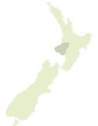

Scroll down to see a more detailed road map and below that a topographical map showing the location of Ohio Stream. The road map has been supplied by openstreetmap and the topographical map of Ohio Stream has been supplied by Land Information New Zealand (LINZ).

Yes you can use the top static map for you school/university project or personal website with a link back. Contact me for any commercial use.
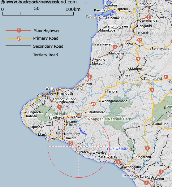
Ohio Stream Map New Zealand


New Zealand places in our database
[ A ] [ B ] [ C ] [ D ] [ E ] [ F ] [ G ] [ H ] [ I ] [ J ] [ K ] [ L ] [ M ] [ N ] [ O ] [ P ] [ Q ] [ R ] [ S ] [ T ] [ U ] [ V ] [ W ] [ X ] [ Y ] [ Z ]


Closest 20 Streams to Ohio Stream

Ngakotana Stream ( 1.54km )   Tenganawhakaruru Stream ( 1.89km )   Tumutu Stream ( 2.14km )   Ohaha Stream ( 2.84km )   Oroua Stream ( 2.94km )   Teahitakawai Stream ( 3.16km )   Pakerata Stream ( 3.31km )   Urekawa Stream ( 4.26km )   Waireka Stream ( 5.58km )   Makino Stream ( 6.22km )   Kakapirau Stream ( 6.39km )   Ingahape Stream ( 7.27km )   Makoro Stream ( 7.38km )   Kaikura Stream ( 7.85km )   Mangaroa Stream ( 7.94km )   Waikaikai Stream ( 8.87km )   Otoki Stream ( 9.94km )   Katoke Stream ( 10.01km )   Poroporo Stream ( 10.64km )   Kokako Stream ( 10.85km )   Hetore Stream ( 11.2km )   Tangahoe River ( 11.74km )   Manawapou River ( 11.77km )   Kakapirau Stream ( 12.02km )   Kohi Stream ( 12.45km )   Upokorau Stream ( 12.62km )   Kaikanui Stream ( 12.87km )   Hurukau Stream ( 14.42km )   Okirau Stream ( 15.16km )   Katewheta Stream ( 15.19km )   Mangatangi Stream ( 15.21km )   Tahuna Stream ( 16.15km )   Kiritae Stream ( 16.34km )   Tangarata Stream ( 16.47km )   Kuranui Stream ( 16.9km )   Toakura Stream ( 17.3km )   Mangarata Stream ( 17.77km )   Wairoa Stream ( 18.54km )   Mangaone Stream ( 19.13km )   Puiatoe Stream ( 19.65km )