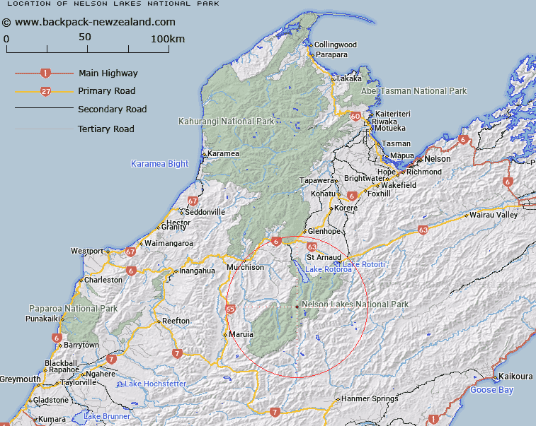
Map showing location of Nelson Lakes National Park
LINZ description: Nelson Lakes National Park (established in 1956) is situated in the north of New Zealand's South Island. It protects 102,000 hectares of the northern most Southern Alps. The park offers tranquil beech forest, craggy mountains, clear streams and lakes both big and small.
The gateway to the park is St Arnaud, a 1-2 hour drive from Nelson or Blenheim.
Latitude: -42.041667
Longitude: 172.607778
Northing: 5345523.1
Easting: 1567538.3
Land District: Nelson
Feat Type: National Park
Latitude: -42.041667
Longitude: 172.607778
Northing: 5345523.1
Easting: 1567538.3
Land District: Nelson
Feat Type: National Park

Scroll down to see a more detailed road map and below that a topographical map showing the location of Nelson Lakes National Park. The road map has been supplied by openstreetmap and the topographical map of Nelson Lakes National Park has been supplied by Land Information New Zealand (LINZ).
Yes you can use the top static map for you school/university project or personal website with a link back. Contact me for any commercial use.
[ A ] [ B ] [ C ] [ D ] [ E ] [ F ] [ G ] [ H ] [ I ] [ J ] [ K ] [ L ] [ M ] [ N ] [ O ] [ P ] [ Q ] [ R ] [ S ] [ T ] [ U ] [ V ] [ W ] [ X ] [ Y ] [ Z ]