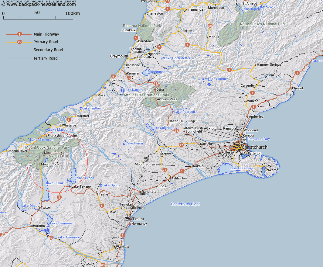
Map showing location of Mount William Grant


LINZ description: Highest peak in Gammack Range, east of the headwaters of the Jollie River.
Latitude: -43.704591
Longitude: 170.32112
Northing: 5157449
Easting: 1384156.7
Land District: Canterbury
Feat Type: Hill


Scroll down to see a more detailed road map and below that a topographical map showing the location of Mount William Grant. The road map has been supplied by openstreetmap and the topographical map of Mount William Grant has been supplied by Land Information New Zealand (LINZ).

Yes you can use the top static map for you school/university project or personal website with a link back. Contact me for any commercial use.

Mount William Grant Map New Zealand


New Zealand places in our database
[ A ] [ B ] [ C ] [ D ] [ E ] [ F ] [ G ] [ H ] [ I ] [ J ] [ K ] [ L ] [ M ] [ N ] [ O ] [ P ] [ Q ] [ R ] [ S ] [ T ] [ U ] [ V ] [ W ] [ X ] [ Y ] [ Z ]


Closest 20 Hills to Mount William Grant

The Needles ( 3.76km )   Abbess ( 4.18km )   Mount Jukes ( 4.78km )   Abbot ( 4.88km )   Mount Bruce ( 4.97km )   Jollie Peak ( 5.33km )   Monastery Peak ( 6.03km )   The Nuns Veil ( 6.06km )   Mount Biretta ( 6.35km )   Mount Little ( 6.87km )   Hells Gates ( 6.87km )   The Acolyte ( 7.02km )   Mount Lucia ( 7.1km )   The Armchair ( 8.12km )   Mount Tamaki ( 8.12km )   Burnett Mountains ( 8.87km )   Brass Peak ( 8.88km )   Mount Fagin ( 8.97km )   Mount Radove ( 9.28km )   Mount Kea ( 10.3km )   Mount Blackburn ( 11.18km )   Novara Peak ( 11.28km )   The Twins ( 11.3km )   Mount Haszard ( 11.59km )   Malcher Peak ( 11.82km )   Taranaki Peak ( 12.02km )   Mount Johnson ( 12.2km )   Mount German ( 12.42km )   Mount Hutton ( 12.49km )   Mount Caitriana ( 13.23km )   Mount Chudleigh ( 13.49km )   Pikes Peak ( 13.6km )   Mount Catherine ( 13.77km )   Mount Nathan ( 13.79km )   Mount Stevenson ( 13.91km )   Corbies Peaks ( 13.91km )   Mount Ronald Adair ( 14.05km )   Aiguilles Rouges ( 14.33km )   Mount Gillies ( 14.35km )   Mount Burnett ( 14.4km )