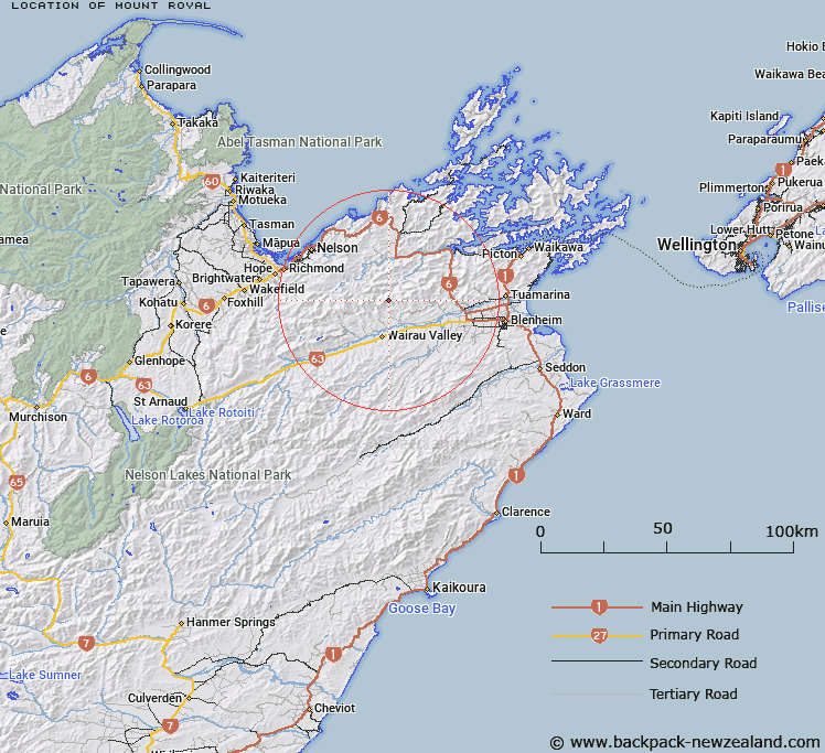
Map showing location of Mount Royal


LINZ description: High point in Mount Richmond State Forest at the headwaters of Quartz Creek.
Latitude: -41.444181
Longitude: 173.550604
Northing: 5411786.5
Easting: 1645994.5
Land District: Marlborough
Feat Type: Hill


Scroll down to see a more detailed road map and below that a topographical map showing the location of Mount Royal. The road map has been supplied by openstreetmap and the topographical map of Mount Royal has been supplied by Land Information New Zealand (LINZ).

Yes you can use the top static map for you school/university project or personal website with a link back. Contact me for any commercial use.

Mount Royal Map New Zealand


New Zealand places in our database
[ A ] [ B ] [ C ] [ D ] [ E ] [ F ] [ G ] [ H ] [ I ] [ J ] [ K ] [ L ] [ M ] [ N ] [ O ] [ P ] [ Q ] [ R ] [ S ] [ T ] [ U ] [ V ] [ W ] [ X ] [ Y ] [ Z ]


Closest 20 Hills to Mount Royal

Mount Fishtail ( 4.65km )   Mount Baldy ( 5.3km )   Mount Bradley ( 10.19km )   Mount Sunday ( 11.24km )   Mount Fell ( 11.78km )   Johnson Peak ( 12.27km )   Johnston Peak ( 12.27km )   Benbown ( 12.63km )   Mount Riley ( 12.65km )   Conical Knob ( 13.21km )   Mount Richmond ( 13.31km )   Waihopai ( 15.14km )   Grass Knob ( 15.95km )   Lansdowne ( 16.19km )   Maungatapu ( 17.61km )   Little Twin ( 17.77km )   Dun Mountain ( 18.45km )   The Rocks ( 18.87km )   Tutumapo ( 18.96km )   T?t?m?pou Hill ( 18.96km )   Mount Claude ( 20.72km )   Wooded Peak ( 20.76km )   Saddle Hill ( 21.2km )   Blue Knob ( 21.29km )   Mount Stewart ( 21.34km )   Mount Olympus ( 22.58km )   Old Man ( 22.61km )   Mount Meares ( 22.81km )   Mount Gale ( 23.11km )   Takorika ( 23.39km )   Slaty Peak ( 23.55km )   Hikurangi / Goulter Hill ( 23.65km )   Wantwood ( 23.79km )   Hacket Peaks ( 23.93km )   Mount Rimu ( 24.08km )   Mount Malita ( 24.26km )   The Pyramid ( 24.32km )   Fringed Hill ( 24.55km )   Mount Starveall ( 25.07km )   Mount Barrett ( 25.1km )