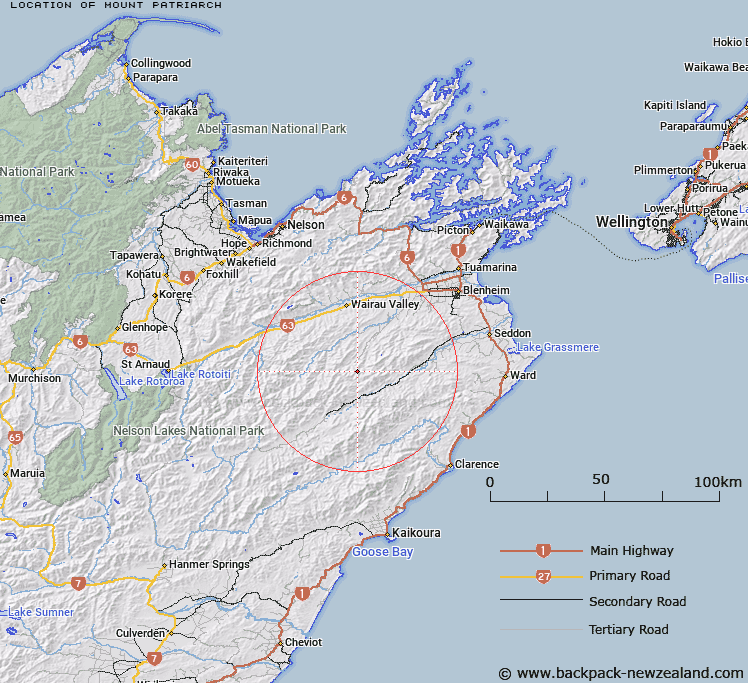
Map showing location of Mount Patriarch


LINZ description: Mountain, 4,280 ft in height, situated in the upper Avon River area, 7 miles north of Upcot Station
Latitude: -41.809318
Longitude: 173.572096
Northing: 5371236.4
Easting: 1647520.9
Land District: Marlborough
Feat Type: Hill


Scroll down to see a more detailed road map and below that a topographical map showing the location of Mount Patriarch. The road map has been supplied by openstreetmap and the topographical map of Mount Patriarch has been supplied by Land Information New Zealand (LINZ).

Yes you can use the top static map for you school/university project or personal website with a link back. Contact me for any commercial use.

Mount Patriarch Map New Zealand


New Zealand places in our database
[ A ] [ B ] [ C ] [ D ] [ E ] [ F ] [ G ] [ H ] [ I ] [ J ] [ K ] [ L ] [ M ] [ N ] [ O ] [ P ] [ Q ] [ R ] [ S ] [ T ] [ U ] [ V ] [ W ] [ X ] [ Y ] [ Z ]


Closest 20 Hills to Mount Patriarch

Mount Delight ( 0.34km )   Mount Hall ( 2.19km )   Woody Peak ( 2.5km )   Rocky Gill ( 2.75km )   Mount Abrupt ( 3.06km )   Judy ( 3.1km )   Mount Boltoff ( 3.42km )   Mount Alexander ( 3.97km )   Glenlee South ( 5.26km )   Glenlee North ( 5.28km )   Gordons Knob ( 5.38km )   Star Hill ( 6.37km )   Barometer ( 6.48km )   Pudding Hill ( 6.98km )   Jacks Brother ( 7.08km )   Ferny Gair ( 7.31km )   Glenlee ( 7.62km )   Jack ( 7.82km )   Snowdon ( 8.93km )   Big Bolton ( 9.27km )   Green Hill ( 9.44km )   Mount Elliott ( 9.87km )   Old Pudding ( 10.75km )   Little Bolton ( 11.04km )   Doctors Knob ( 11.09km )   Big Castle ( 11.19km )   Reserve Hill ( 11.85km )   Stronvar ( 12.61km )   The Pinnacles ( 12.74km )   Little Castle ( 12.86km )   Spray ( 12.93km )   Horseshoe Hill ( 13.58km )   Hodder ( 13.65km )   Otterson ( 14.4km )   Mount Horrible ( 14.68km )   Cow Hill ( 14.71km )   Wether Hill ( 14.78km )   Conical Hill ( 14.83km )   Benhopai ( 15.29km )   Mount Upcot ( 15.74km )