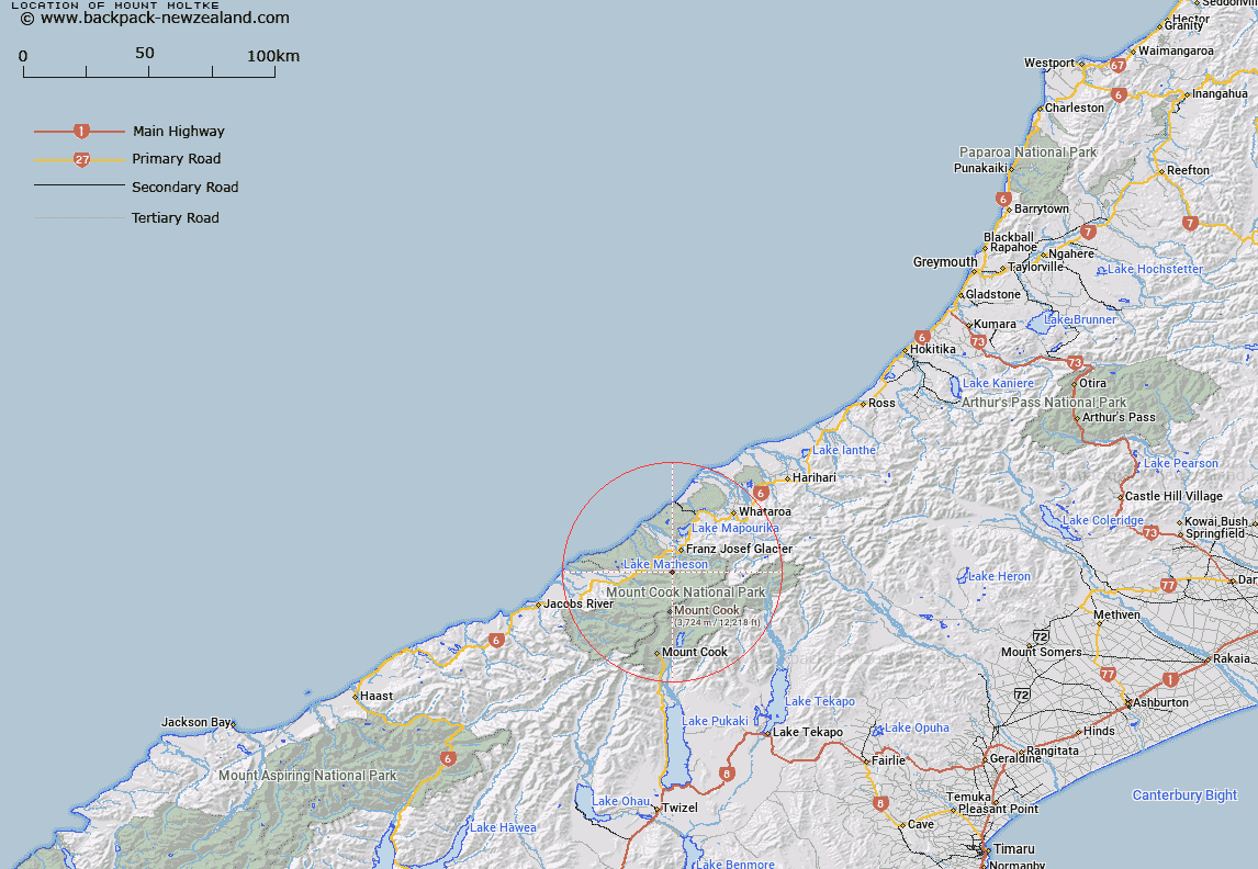
Map showing location of Mount Moltke


LINZ description: Feature shown on: NZMS260 H34 G35 H35 Edition 1 1993 Reprinted 1995
Latitude: -43.459917
Longitude: 170.15125
Northing: 5184167.6
Easting: 1369537.2
Land District: Westland
Feat Type: Hill


Scroll down to see a more detailed road map and below that a topographical map showing the location of Mount Moltke. The road map has been supplied by openstreetmap and the topographical map of Mount Moltke has been supplied by Land Information New Zealand (LINZ).

Yes you can use the top static map for you school/university project or personal website with a link back. Contact me for any commercial use.
Mount Moltke Map New Zealand


New Zealand places in our database
[ A ] [ B ] [ C ] [ D ] [ E ] [ F ] [ G ] [ H ] [ I ] [ J ] [ K ] [ L ] [ M ] [ N ] [ O ] [ P ] [ Q ] [ R ] [ S ] [ T ] [ U ] [ V ] [ W ] [ X ] [ Y ] [ Z ]


Closest 20 Hills to Mount Moltke

Mount Moltke ( 0km )   Lemmer Peak ( 1.18km )   Mount Roon ( 2.62km )   Ebenezer Peak ( 2.77km )   Mount Gaskell ( 3.21km )   Mount Purity ( 3.23km )   Mount McIntosh ( 3.5km )   Alex Knob ( 3.58km )   Mount Ferguson ( 3.82km )   Mount Anderegg ( 4.03km )   Louisa Peak ( 4.11km )   Sentinel Rock ( 4.17km )   Mount Vickers ( 4.21km )   Mount Gunn ( 4.28km )   Goatpath ( 4.53km )   Crawford Knob ( 4.63km )   Annie Peak ( 4.64km )   Bismarck Peaks ( 5.11km )   Thelma Peak ( 5.27km )   Chancellor Dome ( 5.73km )   Mount Von Bulow ( 6.03km )   Mount Halcombe ( 6.42km )   Newton Rocks ( 6.51km )   Sugar Loaf ( 6.63km )   Mount Christie ( 6.76km )   Mount Mitchell ( 6.85km )   West Hoe ( 7.24km )   Saint Mildred Peak ( 7.26km )   Mount Mueller ( 7.44km )   Triad Peak ( 7.78km )   Tusk ( 7.9km )   Mount Burster ( 7.93km )   Mount Garnier ( 8.05km )   Mackay Rocks ( 8.19km )   Drummond Peak ( 8.39km )   Mount Mallory ( 8.4km )   Mount Barnicoat ( 8.72km )   Canavans Knob ( 8.82km )   Mount Aurora ( 9.06km )   Mount Spencer ( 9.06km )