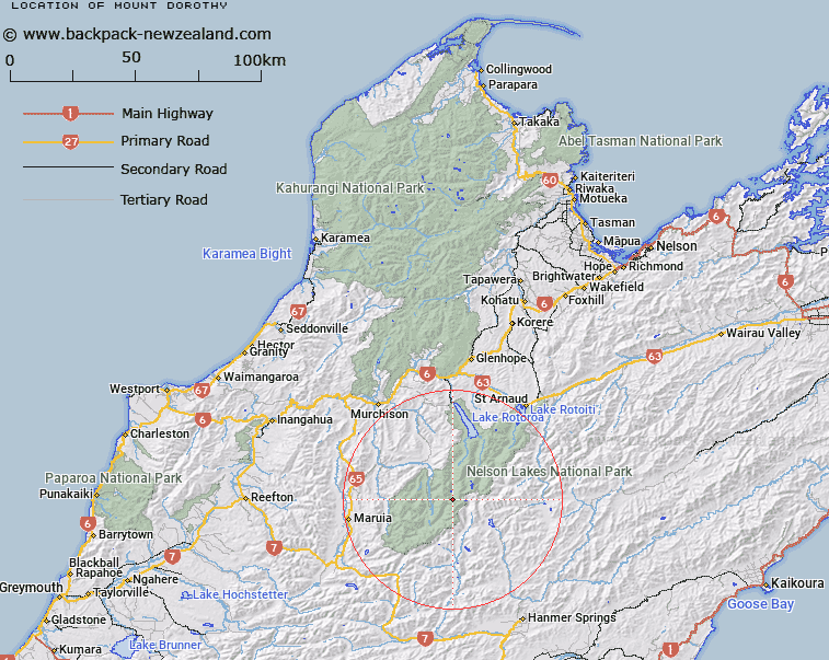
Map showing location of Mount Dorothy


LINZ description: Mountain at the south end of Ella Range 7175 feet high
Latitude: -42.121671
Longitude: 172.584118
Northing: 5336630.9
Easting: 1565623.3
Land District: Nelson
Feat Type: Hill


Scroll down to see a more detailed road map and below that a topographical map showing the location of Mount Dorothy. The road map has been supplied by openstreetmap and the topographical map of Mount Dorothy has been supplied by Land Information New Zealand (LINZ).

Yes you can use the top static map for you school/university project or personal website with a link back. Contact me for any commercial use.

Mount Dorothy Map New Zealand


New Zealand places in our database
[ A ] [ B ] [ C ] [ D ] [ E ] [ F ] [ G ] [ H ] [ I ] [ J ] [ K ] [ L ] [ M ] [ N ] [ O ] [ P ] [ Q ] [ R ] [ S ] [ T ] [ U ] [ V ] [ W ] [ X ] [ Y ] [ Z ]


Closest 20 Hills to Mount Dorothy

Mount Magdalene ( 1.42km )   Downie ( 3.44km )   Spenser Range ( 4.55km )   Spenser Mountains ( 4.55km )   Mount Ella ( 4.55km )   Mount Mahanga ( 4.75km )   Mount Humboldt ( 6.52km )   Crag ( 7.48km )   Aeneid Peak ( 8.4km )   Enid Peak ( 8.4km )   Mount Una ( 10.58km )   Mount Princess ( 10.91km )   Duessa Peak ( 11.11km )   Mount Guinevere ( 11.37km )   Belvedere Peak ( 11.46km )   Mount Franklin ( 11.57km )   Mount Dora ( 11.76km )   Emily Peaks ( 12.01km )   Mount Burn ( 12.23km )   Mount Watson ( 12.7km )   Mount McKay ( 12.81km )   Mount Moki ( 12.97km )   Crystal Peak ( 13.08km )   Nardoo ( 13.09km )   Mount McCabe ( 13.23km )   Mount Paske ( 13.5km )   Mount Maling ( 14.8km )   Windward Peak ( 14.85km )   Hill Forty ( 15.61km )   Southey Mount ( 16.1km )   Yanks Hill ( 16.32km )   Mount Maling ( 16.64km )   Mole Tops ( 16.82km )   Faerie Queene Peak ( 16.84km )   Baldy ( 16.99km )   Kehu Peak ( 17.09km )   Mount Travers ( 17.32km )   Gloriana Peak ( 17.92km )   Mount Stanley ( 18.09km )   Mount Iris ( 18.7km )