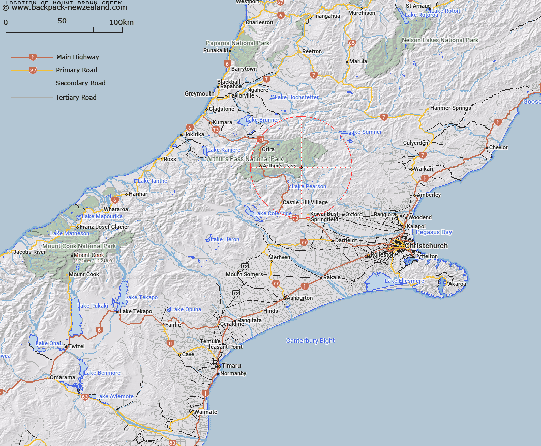
Map showing location of Mount Brown Creek


LINZ description: Between the Poulter River to the east and the Waimakariri River to the westnorth of the Binseer Saddle.
Latitude: -42.951986
Longitude: 171.872164
Northing: 5243900
Easting: 1508000
Land District: Canterbury
Feat Type: Stream


Scroll down to see a more detailed road map and below that a topographical map showing the location of Mount Brown Creek. The road map has been supplied by openstreetmap and the topographical map of Mount Brown Creek has been supplied by Land Information New Zealand (LINZ).

Yes you can use the top static map for you school/university project or personal website with a link back. Contact me for any commercial use.

Mount Brown Creek Map New Zealand


New Zealand places in our database
[ A ] [ B ] [ C ] [ D ] [ E ] [ F ] [ G ] [ H ] [ I ] [ J ] [ K ] [ L ] [ M ] [ N ] [ O ] [ P ] [ Q ] [ R ] [ S ] [ T ] [ U ] [ V ] [ W ] [ X ] [ Y ] [ Z ]


Closest 20 Streams to Mount Brown Creek

Poulter River East Branch ( 3.83km )   Trinity Stream ( 4.41km )   Turnbull Stream ( 4.42km )   Pete Stream ( 4.61km )   Cleland Stream ( 4.88km )   Pampas Stream ( 5.57km )   Surprise Stream ( 5.76km )   Casey Stream ( 6.22km )   Andrews Stream ( 6.65km )   Lower Farm Stream ( 6.9km )   Boundary Stream ( 7.95km )   Riversdale Stream ( 8.15km )   East Hawdon Stream ( 8.76km )   Bush Stream ( 8.84km )   Beckett Stream ( 8.85km )   Fenwick Stream ( 9.77km )   Hawdon River ( 10.63km )   Poverty Stream ( 11.19km )   Camp Stream ( 11.33km )   Row Stream ( 11.91km )   Trudge Stream ( 12.19km )   Gooseberry Stream ( 12.26km )   Ranger Stream ( 12.38km )   Lochinvar Stream ( 12.46km )   Discovery Stream ( 12.56km )   Grasmere Stream ( 12.74km )   Nigger Stream ( 12.99km )   P?kio Stream ( 12.99km )   Sudden Valley Stream ( 13.01km )   Twin Fall Stream ( 13.19km )   Baldy Stream ( 13.35km )   Enchanted Stream ( 13.85km )   Letitia Stream ( 13.9km )   Minchin Stream ( 13.99km )   Cox River ( 14.35km )   Cochran Stream ( 14.42km )   Morrison Stream ( 14.86km )   Sailor Stream ( 14.88km )   Otehake River East Branch ( 15km )   Montgomery Stream ( 15.09km )