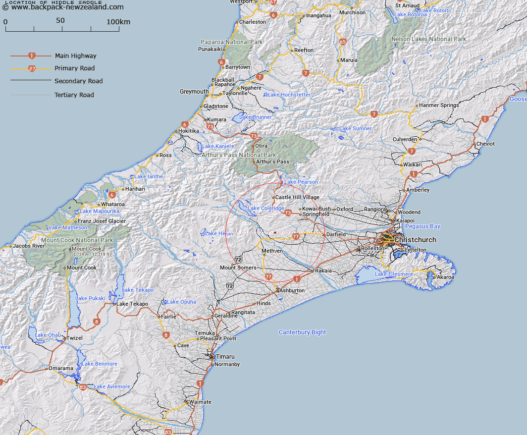
Map showing location of Middle Saddle


LINZ description: Saddle in the Rockwood range 1km West by South-west of High Peak [Trig. G (Geodetic Code 1123)]. Block VII Hororata Survey District.
Latitude: -43.470977
Longitude: 171.730426
Northing: 5186099.1
Easting: 1497312.6
Land District: Canterbury
Feat Type: Pass


Scroll down to see a more detailed road map and below that a topographical map showing the location of Middle Saddle. The road map has been supplied by openstreetmap and the topographical map of Middle Saddle has been supplied by Land Information New Zealand (LINZ).

Yes you can use the top static map for you school/university project or personal website with a link back. Contact me for any commercial use.

Middle Saddle Map New Zealand


New Zealand places in our database
[ A ] [ B ] [ C ] [ D ] [ E ] [ F ] [ G ] [ H ] [ I ] [ J ] [ K ] [ L ] [ M ] [ N ] [ O ] [ P ] [ Q ] [ R ] [ S ] [ T ] [ U ] [ V ] [ W ] [ X ] [ Y ] [ Z ]


Closest 20 Passs to Middle Saddle

High Peak Saddle ( 4.13km )   Phillips Saddle ( 5.59km )   Limestone Saddle ( 8.56km )   Yorkies Saddle ( 8.76km )   Hill Saddle ( 9.19km )   Pig Saddle ( 17.19km )   Porters Pass ( 19.53km )   Coleridge Pass ( 21.18km )   Redcliff Saddle ( 22.56km )   The Gap ( 24.49km )   Turtons Saddle ( 31.74km )   West Hoe Pass ( 32.13km )   Peache Saddle ( 33.95km )   Quaker Saddle ( 35.92km )   Clent Hills Saddle ( 35.97km )   Gargarus Saddle ( 38.69km )   Big Ben Saddle ( 40.22km )   Cass Saddle ( 40.81km )   Ashley Saddle ( 41.33km )   Long Hill Saddle ( 42.9km )   St Bernard Saddle ( 44.89km )   Red Saddle ( 45.6km )   Bruce Saddle ( 46.34km )   Lagoon Saddle ( 48.15km )   Jordan Saddle ( 50.14km )   Brown Saddle ( 50.43km )   Goldney Saddle ( 50.77km )   Half Moon Saddle ( 51.31km )   Binser Saddle ( 53.27km )   Excellent Saddle ( 53.34km )   Sphinx Saddle ( 53.47km )   Echo Col ( 54.28km )   Poachers Pass ( 54.78km )   Gizeh Col ( 55.22km )   Fools Col ( 55.67km )   Greenlaw Col ( 56.48km )   Moa Saddle ( 57.42km )   Boulder Col ( 57.85km )   Peg Col ( 58.28km )   Williams Saddle ( 58.62km )