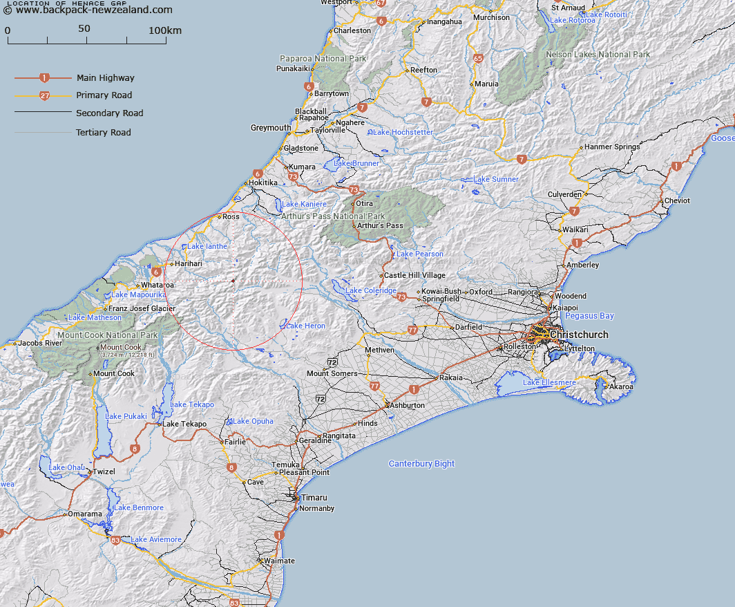
Map showing location of Menace Gap


LINZ description: Col on Main Divide 300m north-east of Mount Roberts, at the head of the Hazard Glacier. Whitcombe Pass Survey District.
Latitude: -43.237138
Longitude: 170.892854
Northing: 5210695.2
Easting: 1428909.5
Land District: Canterbury, Westland
Feat Type: Pass


Scroll down to see a more detailed road map and below that a topographical map showing the location of Menace Gap. The road map has been supplied by openstreetmap and the topographical map of Menace Gap has been supplied by Land Information New Zealand (LINZ).

Yes you can use the top static map for you school/university project or personal website with a link back. Contact me for any commercial use.

Menace Gap Map New Zealand


New Zealand places in our database
[ A ] [ B ] [ C ] [ D ] [ E ] [ F ] [ G ] [ H ] [ I ] [ J ] [ K ] [ L ] [ M ] [ N ] [ O ] [ P ] [ Q ] [ R ] [ S ] [ T ] [ U ] [ V ] [ W ] [ X ] [ Y ] [ Z ]


Closest 20 Passs to Menace Gap

Strachan Pass ( 2.08km )   Camp Saddle ( 4.84km )   Erewhon Col ( 5.16km )   Full Moon Saddle ( 5.23km )   Red Lion Col ( 5.81km )   Whitcombe Pass ( 6.37km )   McKenzie Col ( 7.2km )   Chowbok Col ( 9.52km )   Ambrose Saddle ( 10.22km )   Malcolm Col ( 10.39km )   Gladiator Col ( 10.4km )   Seddon Col ( 10.41km )   Gadarene Col ( 10.42km )   Rangitata Col ( 11.06km )   McCoy Col ( 11.2km )   Lambert Col ( 11.21km )   Reischek Col ( 11.92km )   Lawrence Col ( 12.08km )   Toledo Col ( 12.24km )   Battleaxe Col ( 13.18km )   Bandolero Col ( 13.26km )   Crossbow Saddle ( 13.3km )   Musterers Col ( 13.67km )   Cameron Col ( 14.33km )   Jagged Col ( 14.69km )   Satan Saddle ( 15.08km )   Ridland Saddle ( 15.49km )   Groove Col ( 15.54km )   Boulder Col ( 15.82km )   Peg Col ( 15.96km )   Perth Col ( 18.18km )   Lucknow Saddle ( 18.18km )   Poachers Pass ( 18.94km )   Adams Col ( 19km )   Disappointment Saddle ( 19.83km )   Dickson Pass ( 19.92km )   Havelock Col ( 20.39km )   Kea Pass ( 20.51km )   Angel Col ( 20.66km )   Veil Col ( 21.19km )