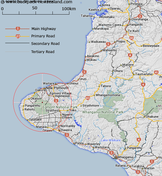
Map showing location of Maude Peak
LINZ description: Located on the lower northern slopes of Mount Taranaki or Mount Egmont, at height 1220m. NZTopo50 BJ29-Mount Taranaki or Mount Egmont, GR 911 565.
Latitude: -39.235863
Longitude: 174.055273
Northing: 5656518.4
Easting: 1691074.8
Land District: Taranaki
Feat Type: Hill
Latitude: -39.235863
Longitude: 174.055273
Northing: 5656518.4
Easting: 1691074.8
Land District: Taranaki
Feat Type: Hill

Scroll down to see a more detailed road map and below that a topographical map showing the location of Maude Peak. The road map has been supplied by openstreetmap and the topographical map of Maude Peak has been supplied by Land Information New Zealand (LINZ).
Yes you can use the top static map for you school/university project or personal website with a link back. Contact me for any commercial use.
[ A ] [ B ] [ C ] [ D ] [ E ] [ F ] [ G ] [ H ] [ I ] [ J ] [ K ] [ L ] [ M ] [ N ] [ O ] [ P ] [ Q ] [ R ] [ S ] [ T ] [ U ] [ V ] [ W ] [ X ] [ Y ] [ Z ]