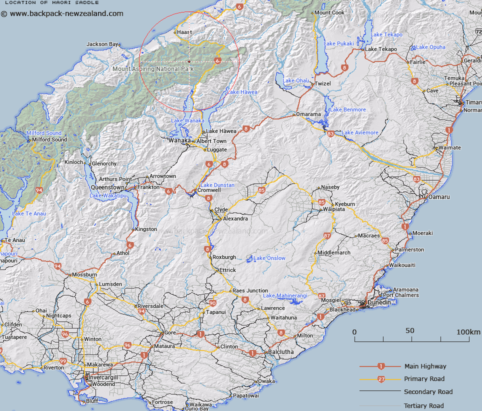
Map showing location of Maori Saddle


LINZ description: Saddle in Southern Alps/Kā Tiritiri o te Moana. Correct position of name as per historic records. Previous position now called Douglas Saddle.
Latitude: -44.09192
Longitude: 169.149954
Northing: 5110707
Easting: 1291795.3
Land District: Otago, Westland
Feat Type: Pass


Scroll down to see a more detailed road map and below that a topographical map showing the location of Maori Saddle. The road map has been supplied by openstreetmap and the topographical map of Maori Saddle has been supplied by Land Information New Zealand (LINZ).

Yes you can use the top static map for you school/university project or personal website with a link back. Contact me for any commercial use.

Maori Saddle Map New Zealand


New Zealand places in our database
[ A ] [ B ] [ C ] [ D ] [ E ] [ F ] [ G ] [ H ] [ I ] [ J ] [ K ] [ L ] [ M ] [ N ] [ O ] [ P ] [ Q ] [ R ] [ S ] [ T ] [ U ] [ V ] [ W ] [ X ] [ Y ] [ Z ]


Closest 20 Passs to Maori Saddle

Topsey Saddle ( 4.44km )   Douglas Saddle ( 4.45km )   The Gateway ( 6.66km )   Mueller Pass ( 6.68km )   Governors Pass ( 7.62km )   Emily Pass ( 8.23km )   Gillespie Pass ( 9.57km )   Siberia Saddle ( 10.2km )   Mistaken Saddle ( 10.44km )   Turnbull Pass ( 11km )   Stewart Pass ( 14.37km )   Mac Saddle ( 16.2km )   Haast Pass ( 16.45km )   Haast Pass/Tioripatea ( 16.45km )   Newland Pass ( 16.56km )   Te Naihi Saddle ( 18.17km )   Te Naihi Pass ( 18.17km )   Chasm Pass ( 29.81km )   Wills Pass ( 31.33km )   Waiatoto Saddle ( 32.11km )   Maori Saddle ( 32.33km )   Pearson Saddle ( 34.2km )   Rabbit Pass ( 34.3km )   Upper Studholme Pass ( 36.73km )   Wilson Pass ( 36.91km )   Lower Studholme Pass ( 37.24km )   The Neck ( 38.24km )   Power Notch ( 38.29km )   Wilmot Saddle ( 40.21km )   Albert Burn Saddle ( 40.23km )   Rainbow Col ( 42.89km )   Macfarlane Pass ( 43.52km )   Clarke Pass ( 43.77km )   V Notch Pass ( 44.02km )   Moncrieff Col ( 44.36km )   Parachute Col ( 45.28km )   Martyr Saddle ( 46.46km )   Stafford Saddle ( 47.1km )   McGloin Pass ( 47.55km )   Brodrick Pass ( 47.86km )