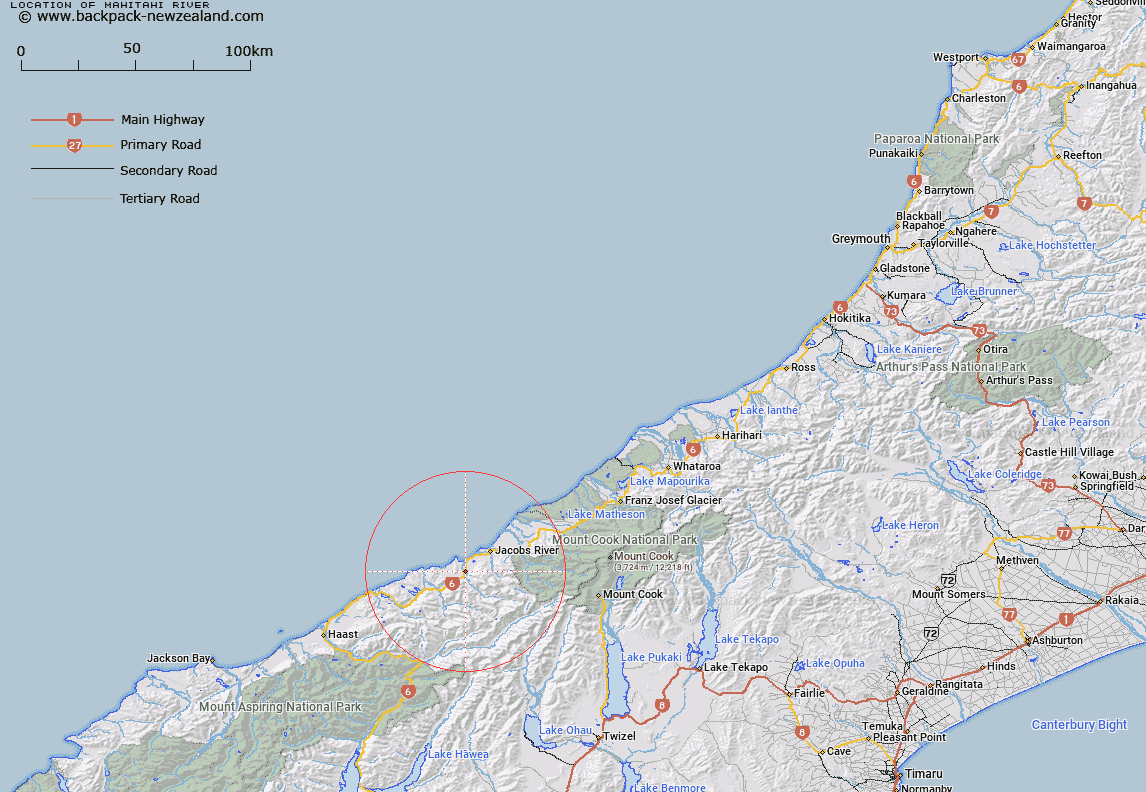
Map showing location of Mahitahi River


LINZ description: River having it's source in the Solution Range, and flowing into the Tasman Sea at Bruce Bay. Bruce Bay Survey District. Feature shown on Infomap 346-02 Te Wai Pounamu Edition 1 1995
Latitude: -43.645637
Longitude: 169.587004
Northing: 5161822.3
Easting: 1324734.8
Land District: Westland
Feat Type: Stream


Scroll down to see a more detailed road map and below that a topographical map showing the location of Mahitahi River. The road map has been supplied by openstreetmap and the topographical map of Mahitahi River has been supplied by Land Information New Zealand (LINZ).

Yes you can use the top static map for you school/university project or personal website with a link back. Contact me for any commercial use.

Mahitahi River Map New Zealand


New Zealand places in our database
[ A ] [ B ] [ C ] [ D ] [ E ] [ F ] [ G ] [ H ] [ I ] [ J ] [ K ] [ L ] [ M ] [ N ] [ O ] [ P ] [ Q ] [ R ] [ S ] [ T ] [ U ] [ V ] [ W ] [ X ] [ Y ] [ Z ]


Closest 20 Streams to Mahitahi River

Flagstaff Creek ( 2.39km )   Makatata Stream ( 2.73km )   Micmac Creek ( 4.32km )   Doughboy Creek ( 4.91km )   Ohinemaka River ( 5.54km )   Blackwater Creek ( 6.77km )   Papakeri Creek ( 6.81km )   Kini Creek ( 7.15km )   Power Creek ( 7.31km )   Cascade Creek ( 8.23km )   Plateau Creek ( 8.39km )   Te Naihi Creek ( 8.43km )   Greer Creek ( 8.53km )   Ruera Creek ( 9.35km )   Makawhio River (Jacobs River) ( 9.41km )   Lennie Creek ( 9.89km )   Waituna Creek ( 10.02km )   Tui Creek ( 10.1km )   Antomany Creek ( 10.12km )   Reynolds Creek ( 10.23km )   Pavo Creek ( 10.58km )   Leo Creek ( 10.66km )   Gorgy Creek ( 10.84km )   Swindle Creek ( 11.16km )   Lagoon Creek ( 11.26km )   Hermann Creek ( 11.3km )   Galena Creek ( 11.44km )   Yankee Dans Creek ( 11.55km )   Morse River ( 11.56km )   Lignite Creek ( 11.59km )   Paringa River ( 11.95km )   Dicks Creek ( 12.32km )   Break Creek ( 12.38km )   Otoko River ( 12.69km )   Pita Creek ( 12.73km )   Jumbo Creek ( 12.85km )   Boundary Creek ( 12.94km )   Hall River ( 12.96km )   Two Eye Stream ( 12.99km )   Sam Creek ( 13.19km )