Map showing location of Londonderry Creek


LINZ description: Feature shown on: NZMS260 E41 Edition 1994 Limited Revision 1996
Latitude: -44.840337
Longitude: 168.674387
Northing: 5025677.4
Easting: 1258127.9
Land District: Otago
Feat Type: Stream


Scroll down to see a more detailed road map and below that a topographical map showing the location of Londonderry Creek. The road map has been supplied by openstreetmap and the topographical map of Londonderry Creek has been supplied by Land Information New Zealand (LINZ).

Yes you can use the top static map for you school/university project or personal website with a link back. Contact me for any commercial use.
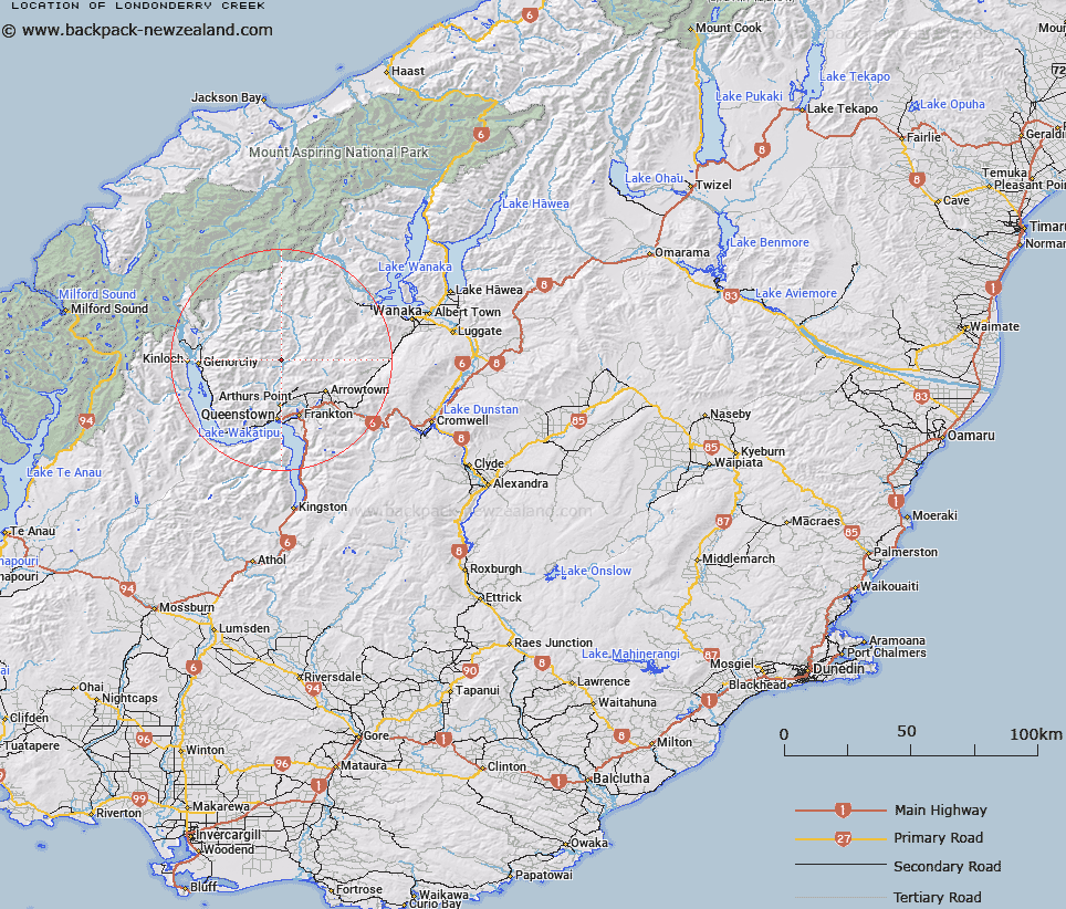
Londonderry Creek Map New Zealand


New Zealand places in our database
[ A ] [ B ] [ C ] [ D ] [ E ] [ F ] [ G ] [ H ] [ I ] [ J ] [ K ] [ L ] [ M ] [ N ] [ O ] [ P ] [ Q ] [ R ] [ S ] [ T ] [ U ] [ V ] [ W ] [ X ] [ Y ] [ Z ]


Closest 20 Streams to Londonderry Creek

Sawyers Creek ( 0.79km )   Jennings Creek ( 1.2km )   Pleasant Creek ( 1.48km )   Elgin Creek ( 2.02km )   Wong Gong Creek ( 2.1km )   Fergusons Creek ( 2.12km )   Skippers Creek ( 2.17km )   Cotters Creek ( 2.4km )   Harrisons Creek ( 2.56km )   Hakaria Left Branch ( 3.03km )   Murphys Creek North ( 3.13km )   Hakaria Right Branch ( 3.24km )   Sainsburys Creek ( 3.98km )   Stony Creek ( 4.17km )   Ballarat or Dead Mans Creek ( 4.42km )   Skippers Creek Left Branch ( 4.49km )   Sandhill Creek ( 5.17km )   Murphys Creek South ( 5.38km )   Roaring Meg ( 5.56km )   Silverhorn Creek ( 5.56km )   Quins Creek or Blue Jacket Creek ( 5.73km )   Skippers Creek Right Branch ( 6.09km )   Old Man Creek ( 6.22km )   Waterfall Creek ( 6.35km )   Aurum Creek ( 6.36km )   Copper Creek ( 6.51km )   Green Gate Creek ( 6.83km )   Upper Stony Creek ( 7.04km )   Deep Creek ( 7.1km )   Hibernia Creek ( 7.15km )   Murdochs Creek ( 7.16km )   Criterion Creek ( 7.56km )   Sawyers Creek ( 7.75km )   Shotover River ( 7.82km )   Stony or Rapid Creek ( 8.09km )   Parkers Creek ( 8.22km )   Jones Creek ( 8.33km )   Bush Creek or Sylvia Creek ( 8.34km )   Blue Creek ( 8.59km )   Lewis Creek ( 9.11km )