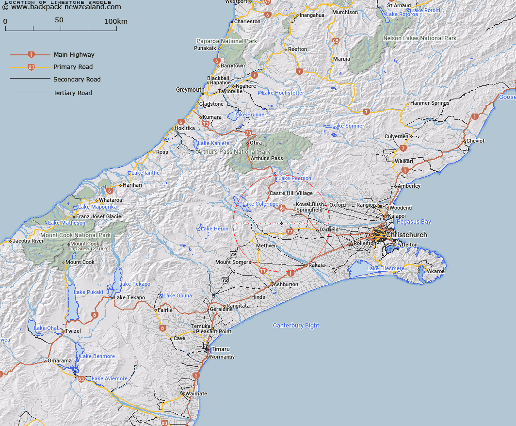
Map showing location of Limestone Saddle


LINZ description: Saddle in the Lady Barker Ranget head of Steventon Stream, 1.8km North-east of Mount Etna. Block II Hororata Survey District.
Latitude: -43.438219
Longitude: 171.826413
Northing: 5189851
Easting: 1505025.1
Land District: Canterbury
Feat Type: Pass


Scroll down to see a more detailed road map and below that a topographical map showing the location of Limestone Saddle. The road map has been supplied by openstreetmap and the topographical map of Limestone Saddle has been supplied by Land Information New Zealand (LINZ).

Yes you can use the top static map for you school/university project or personal website with a link back. Contact me for any commercial use.

Limestone Saddle Map New Zealand


New Zealand places in our database
[ A ] [ B ] [ C ] [ D ] [ E ] [ F ] [ G ] [ H ] [ I ] [ J ] [ K ] [ L ] [ M ] [ N ] [ O ] [ P ] [ Q ] [ R ] [ S ] [ T ] [ U ] [ V ] [ W ] [ X ] [ Y ] [ Z ]


Closest 20 Passs to Limestone Saddle

Hill Saddle ( 0.65km )   High Peak Saddle ( 4.44km )   Yorkies Saddle ( 4.54km )   Phillips Saddle ( 4.72km )   Middle Saddle ( 8.56km )   Pig Saddle ( 8.64km )   Porters Pass ( 17.38km )   The Gap ( 20.82km )   Coleridge Pass ( 22.49km )   West Hoe Pass ( 25.08km )   Redcliff Saddle ( 29.83km )   Big Ben Saddle ( 31.96km )   Ashley Saddle ( 33.14km )   Turtons Saddle ( 38.01km )   Red Saddle ( 38.73km )   Cass Saddle ( 38.85km )   Long Hill Saddle ( 38.99km )   Gargarus Saddle ( 40.49km )   St Bernard Saddle ( 40.88km )   Peache Saddle ( 42.48km )   Clent Hills Saddle ( 43.59km )   Quaker Saddle ( 44.36km )   Bruce Saddle ( 46.39km )   Lagoon Saddle ( 47.15km )   Goldney Saddle ( 47.57km )   Binser Saddle ( 48.8km )   Jordan Saddle ( 50.32km )   Half Moon Saddle ( 52.99km )   Sphinx Saddle ( 53.97km )   Echo Col ( 55.03km )   Gizeh Col ( 56.05km )   Fools Col ( 56.38km )   Williams Saddle ( 56.53km )   Casey Saddle ( 56.89km )   Okuku Saddle ( 57.04km )   Excellent Saddle ( 57.31km )   Greenlaw Col ( 57.39km )   Brown Saddle ( 58.95km )   Amber Col ( 60.03km )   White Col ( 60.19km )