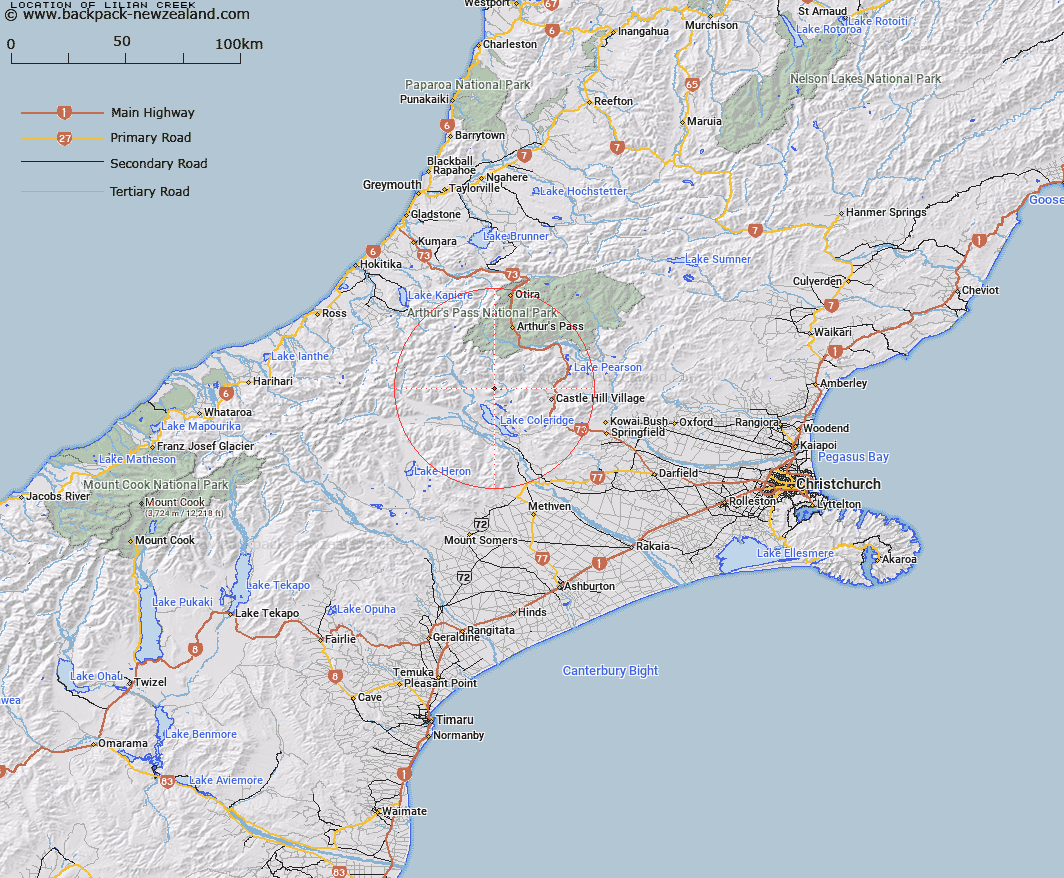
Map showing location of Lilian Creek


LINZ description: Stream rising near Gargarus Saddle and flows generally easterly into Lake Lilian, thence easterly and southerly into Harper River. Harper Survey District.
Latitude: -43.169171
Longitude: 171.495417
Northing: 5219300
Easting: 1477700
Land District: Canterbury
Feat Type: Stream


Scroll down to see a more detailed road map and below that a topographical map showing the location of Lilian Creek. The road map has been supplied by openstreetmap and the topographical map of Lilian Creek has been supplied by Land Information New Zealand (LINZ).

Yes you can use the top static map for you school/university project or personal website with a link back. Contact me for any commercial use.

Lilian Creek Map New Zealand


New Zealand places in our database
[ A ] [ B ] [ C ] [ D ] [ E ] [ F ] [ G ] [ H ] [ I ] [ J ] [ K ] [ L ] [ M ] [ N ] [ O ] [ P ] [ Q ] [ R ] [ S ] [ T ] [ U ] [ V ] [ W ] [ X ] [ Y ] [ Z ]


Closest 20 Streams to Lilian Creek

Gargarus Stream ( 3.54km )   Fisher Stream ( 3.56km )   Triangle Creek ( 4.14km )   Centre Creek ( 4.67km )   Glenthorne Stream ( 4.97km )   Harper River ( 5.1km )   Corner Creek ( 5.37km )   Catherine Stream ( 5.87km )   Moss Burn ( 5.9km )   Mid Basin Creek ( 6.18km )   Boundary Stream ( 6.46km )   Hanging Basin Creek ( 6.49km )   Harper River Diversion ( 6.66km )   Wilberforce Canal ( 6.81km )   Oakden Canal ( 7.58km )   Front Basin Stream ( 7.9km )   Lake Stream ( 7.95km )   Hidden Creek ( 8.17km )   Monckburn ( 8.49km )   Idaburn ( 8.75km )   Basin Creek ( 9.4km )   Amphitheatre Creek ( 9.59km )   Chamois Stream ( 9.66km )   Hut Creek ( 10.45km )   Hennah Stream ( 10.66km )   Ryton River ( 10.71km )   Tarn Creek ( 10.83km )   Fanghill Stream ( 11.25km )   Cockayne Creek ( 11.36km )   Wilberforce River ( 11.55km )   Galilee Creek ( 11.88km )   Windy Creek ( 12.05km )   Junction Stream ( 12.19km )   Goldney River ( 12.2km )   Long Creek ( 12.74km )   Fall Creek ( 12.92km )   Boulderstone Stream ( 12.95km )   Easy Stream ( 13.61km )   Waterfall Creek ( 13.68km )   Avoca River ( 13.73km )