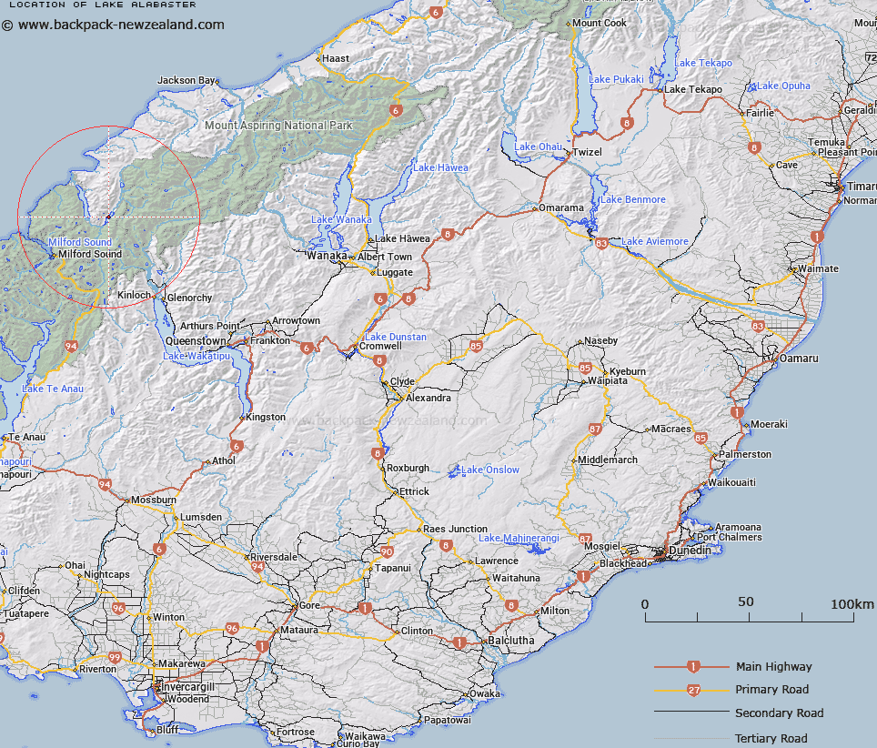
Map showing location of Lake Alabaster


LINZ description: Feature shown on: NZMS260-D39 255215; Infomap 346-02 Te Wai Pounamu Edition 1 1995; NZTopo50-CA09 151591
Latitude: -44.518566
Longitude: 168.157122
Northing: 5059110
Easting: 1215116.3
Land District: Otago
Feat Type: Lake


Scroll down to see a more detailed road map and below that a topographical map showing the location of Lake Alabaster. The road map has been supplied by openstreetmap and the topographical map of Lake Alabaster has been supplied by Land Information New Zealand (LINZ).

Yes you can use the top static map for you school/university project or personal website with a link back. Contact me for any commercial use.

Lake Alabaster Map New Zealand


New Zealand places in our database
[ A ] [ B ] [ C ] [ D ] [ E ] [ F ] [ G ] [ H ] [ I ] [ J ] [ K ] [ L ] [ M ] [ N ] [ O ] [ P ] [ Q ] [ R ] [ S ] [ T ] [ U ] [ V ] [ W ] [ X ] [ Y ] [ Z ]


Closest 20 Lakes to Lake Alabaster

Lake Speden ( 2.55km )   Lake Mantle ( 3.05km )   Lake Never ( 7.46km )   Fohn Lakes ( 8.4km )   Lake Agnes ( 9.89km )   Lake McKerrow/Whakatipu Waitai ( 10.75km )   Lake McKerrow ( 10.75km )   Lake Truth ( 11km )   Lake Iceberg ( 12.35km )   Lake Mystery ( 13.21km )   Nerine Lake ( 13.49km )   Lake Hyslop ( 14.63km )   Lake Unknown ( 15.56km )   Lake Wilmot ( 15.66km )   Lake Never-never ( 16.7km )   Pukutahi Lake ( 17.76km )   Lake Turner ( 18km )   Rainbow Lake ( 19.82km )   McKenzie Lagoon ( 20.35km )   Lake Wilson ( 20.85km )   Crescent Lake ( 20.97km )   Lake Williamson ( 22.86km )   Lake Harris ( 23.04km )   Waiuna Lagoon ( 23.85km )   Lake Adelaide ( 24.38km )   Lake Sylvan ( 24.38km )   Lake Silvan ( 24.38km )   Lake Mackenzie ( 27.29km )   Lake Mariana ( 27.39km )   Black Lake ( 27.57km )   Lake Marianette ( 27.61km )   Diamond Lake ( 29.95km )   Lake Marian ( 30.44km )   Lake Roberts ( 31.52km )   Lake Ada ( 31.75km )   Lake Reid ( 32.76km )   Lake Howden ( 33.51km )   Lake Thompson ( 33.72km )   Buttercup Lake ( 34.23km )   Lake Lochie ( 34.86km )