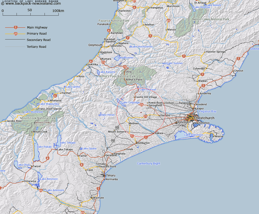
Map showing location of Lady Barker Range


LINZ description: Range of hills South of Selwyn River, from High Peak Saddle, through Hill Saddle, to peak Flagpole. Blocks II, V, and VI Hororata Survey District.
Latitude: -43.441637
Longitude: 171.823257
Northing: 5189467.8
Easting: 1504775
Land District: Canterbury
Feat Type: Range


Scroll down to see a more detailed road map and below that a topographical map showing the location of Lady Barker Range. The road map has been supplied by openstreetmap and the topographical map of Lady Barker Range has been supplied by Land Information New Zealand (LINZ).

Yes you can use the top static map for you school/university project or personal website with a link back. Contact me for any commercial use.

Lady Barker Range Map New Zealand


New Zealand places in our database
[ A ] [ B ] [ C ] [ D ] [ E ] [ F ] [ G ] [ H ] [ I ] [ J ] [ K ] [ L ] [ M ] [ N ] [ O ] [ P ] [ Q ] [ R ] [ S ] [ T ] [ U ] [ V ] [ W ] [ X ] [ Y ] [ Z ]


Closest 20 Ranges to Lady Barker Range

Rockwood Range ( 8.71km )   Russell Range ( 10.04km )   Big Ben Range ( 11.28km )   Torlesse Range ( 22.62km )   Mount Hutt Range ( 24.44km )   Pudding Hill Range ( 28.02km )   Craigieburn Range ( 31.56km )   Alford Range ( 32.66km )   Black Hill Range ( 34.16km )   Clay Range ( 34.74km )   Cottons Sheep Range ( 35.16km )   Old Man Range ( 39.22km )   Winterslow Range ( 39.25km )   Taylor Range ( 40.92km )   Grey Range ( 41.83km )   Mount Somers Range ( 42.72km )   Kingsdown Hills ( 46.77km )   Manuka Range ( 47.11km )   Longman Range ( 47.46km )   Palmer Range ( 49.33km )   Birdwood Range ( 49.64km )   Gawler Downs ( 50.66km )   Clent Hills ( 51.34km )   Tobacco Range ( 51.54km )   Surrey Hills ( 52.21km )   Black Range ( 52.21km )   Peter Range ( 54.93km )   Pancake Range ( 55.39km )   Polar Range ( 57.52km )   Savannah Range ( 58.6km )   Cascade Range ( 58.64km )   Moorhouse Range ( 58.93km )   Rolleston Range ( 59.1km )   Puketeraki Range ( 60.5km )   Okuku Range ( 61.11km )   Shaler Range ( 62.9km )   Poulter Range ( 63.11km )   Ragged Range ( 64.54km )   Wild Mans Brother Range ( 65.05km )   Big Hill Range ( 65.97km )