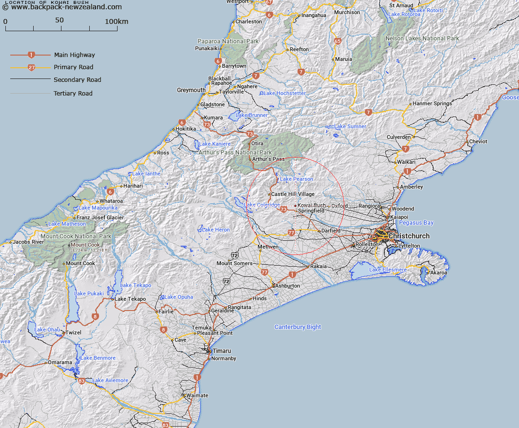
Map showing location of Kowai Bush


LINZ description: Kowai is the South Island rendering of Kowhai.
Latitude: -43.294677
Longitude: 171.925023
Northing: 5205900
Easting: 1512800
Land District: Canterbury
Feat Type: Locality


Scroll down to see a more detailed road map and below that a topographical map showing the location of Kowai Bush. The road map has been supplied by openstreetmap and the topographical map of Kowai Bush has been supplied by Land Information New Zealand (LINZ).

Yes you can use the top static map for you school/university project or personal website with a link back. Contact me for any commercial use.

Kowai Bush Map New Zealand


New Zealand places in our database
[ A ] [ B ] [ C ] [ D ] [ E ] [ F ] [ G ] [ H ] [ I ] [ J ] [ K ] [ L ] [ M ] [ N ] [ O ] [ P ] [ Q ] [ R ] [ S ] [ T ] [ U ] [ V ] [ W ] [ X ] [ Y ] [ Z ]


Closest 20 Localitys to Kowai Bush

Otarama ( 1.76km )   Springfield ( 4.75km )   Staircase ( 7.95km )   Rockford ( 8.95km )   Russells Flat ( 9.63km )   Annat ( 10.19km )   View Hill ( 11.84km )   Bexley ( 12.84km )   Sheffield ( 12.92km )   Waddington ( 14.51km )   Coopers Creek ( 14.76km )   Avoca ( 14.99km )   Gammans Creek ( 18.4km )   Whitecliffs ( 18.66km )   South Malvern ( 19.63km )   Racecourse Hill ( 19.87km )   Glentunnel ( 20.8km )   Coalgate ( 21.08km )   Homebush ( 21.32km )   Oxford ( 21.32km )   Craigieburn ( 22.15km )   Hawkins ( 23.08km )   Kimberley ( 23.16km )   The Warren ( 23.3km )   Ashley Gorge ( 25.55km )   Lees Valley ( 25.73km )   Glenroy ( 26.22km )   Darfield ( 26.35km )   Hororata ( 27.21km )   Eyrewell ( 28.59km )   Carleton ( 28.84km )   Windwhistle ( 29.8km )   Glentui ( 30.04km )   Bennetts ( 30.09km )   Courtenay ( 30.93km )   Cass ( 31.77km )   Kirwee ( 32.69km )   Lake Coleridge ( 32.72km )   Horrellville ( 33km )   Horrelville ( 33km )