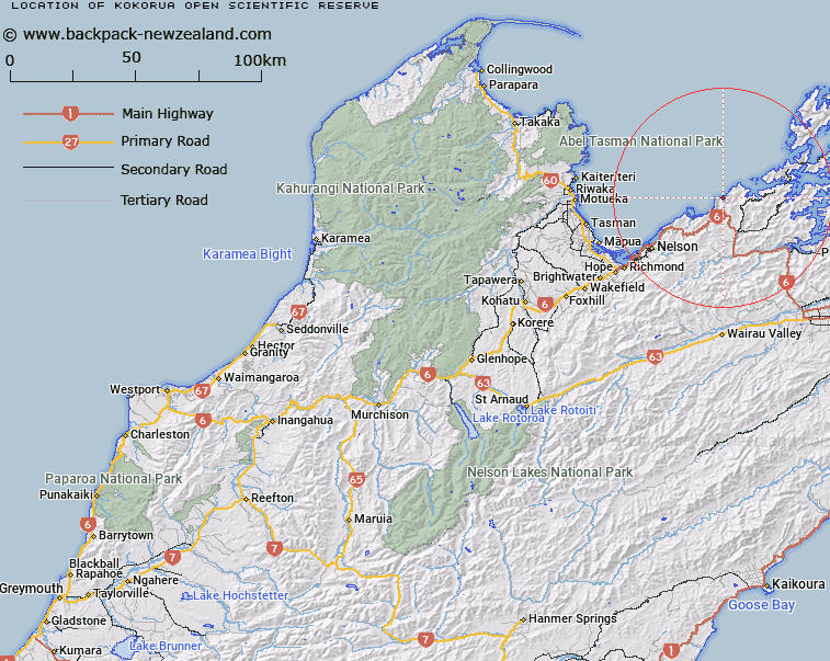
Map showing location of Kokorua Open Scientific Reserve


LINZ description: Section 1 SO 434602. A sand spit located approximately 40km northeast of Nelson at the mouth of Whangamoa River. The occupation site is on a low promontory on the estuary side of the sand spit, extending towards the inlet. There are exposed middens on eroding sections of the inshore banks of the promontory and argillite flakes can be seen scattered on the shoreline. According to the Nelson/Marlborough Conservancy Historic Places Register, the site’s significance is demonstrated by the quantity of artefactual and faunal material recovered from the site.
Latitude: -41.102436
Longitude: 173.532324
Northing: 5449735
Easting: 1644700
Land District: Nelson
Feat Type: Scientific Reserve


Scroll down to see a more detailed road map and below that a topographical map showing the location of Kokorua Open Scientific Reserve. The road map has been supplied by openstreetmap and the topographical map of Kokorua Open Scientific Reserve has been supplied by Land Information New Zealand (LINZ).

Yes you can use the top static map for you school/university project or personal website with a link back. Contact me for any commercial use.

Kokorua Open Scientific Reserve Map New Zealand


New Zealand places in our database
[ A ] [ B ] [ C ] [ D ] [ E ] [ F ] [ G ] [ H ] [ I ] [ J ] [ K ] [ L ] [ M ] [ N ] [ O ] [ P ] [ Q ] [ R ] [ S ] [ T ] [ U ] [ V ] [ W ] [ X ] [ Y ] [ Z ]


Closest 20 Scientific Reserves to Kokorua Open Scientific Reserve

Tom Shand Scientific Reserve ( 31.24km )   Muritai Scientific Reserve ( 79.8km )   Chancet Rocks Scientific Reserve ( 98.46km )   Sinclair Head Scientific Reserve ( 103.09km )   Red Rocks Scientific Reserve ( 103.8km )   Mana Island Scientific Reserve ( 104.66km )   Mokopuna Scientific Reserve ( 112.75km )   Matiu Scientific Reserve ( 112.89km )   Pukerua Bay Scientific Reserve ( 113.08km )   Makaro Scientific Reserve ( 114.06km )   Lake Kohangapiripiri Wildlife Reserve ( 115.41km )   Lake Kohangatera and Lake Kohangapiripiri Scientific Reserve ( 115.41km )   Taita Scientific Reserve ( 120.45km )   Turakirae Head Scientific Reserve ( 122.11km )   Andrews Pond Scientific Reserve ( 124.82km )   Waikanae Estuary Scientific Reserve ( 126.09km )   Blue Duck Scientific Reserve ( 127.47km )   White Creek Fault Scientific Reserve ( 134.2km )   Kiripiti Scientific Reserve ( 139.31km )   Waiohine Faulted Terraces Scientific Reserve ( 157.18km )   Koputaroa Scientific Reserve ( 163.76km )   Makahika Scientific Reserve ( 164.23km )   Tawhirihoe Scientific Reserve ( 168.26km )   Himatangi Bush Scientific Reserve ( 172.15km )   Whitiau Scientific Reserve ( 178.13km )   Pahaoa Scientific Reserve ( 184.53km )   Culverden Scientific Reserve ( 193.51km )   Medbury Scientific Reserve ( 207.65km )   Maitahi Scientific Reserve ( 219.93km )   Ngaurukehu Scientific Reserve ( 249.45km )   Mimi Gorge Scientific Reserve ( 251.36km )   Waimarino Scientific Reserve ( 267.18km )   Eyrewell Scientific Reserve ( 276.46km )   Te Maire Scientific Reserve ( 276.85km )   Enys Scientific Reserve ( 277.2km )   Mahoenui Giant Weta Scientific Reserve ( 303.38km )   Bankside Scientific Reserve ( 313.15km )   Kaitorete Spit Scientific Reserve ( 313.23km )   Waihora Scientific Reserve ( 313.62km )   Opawa Bush Scientific Reserve ( 322.65km )