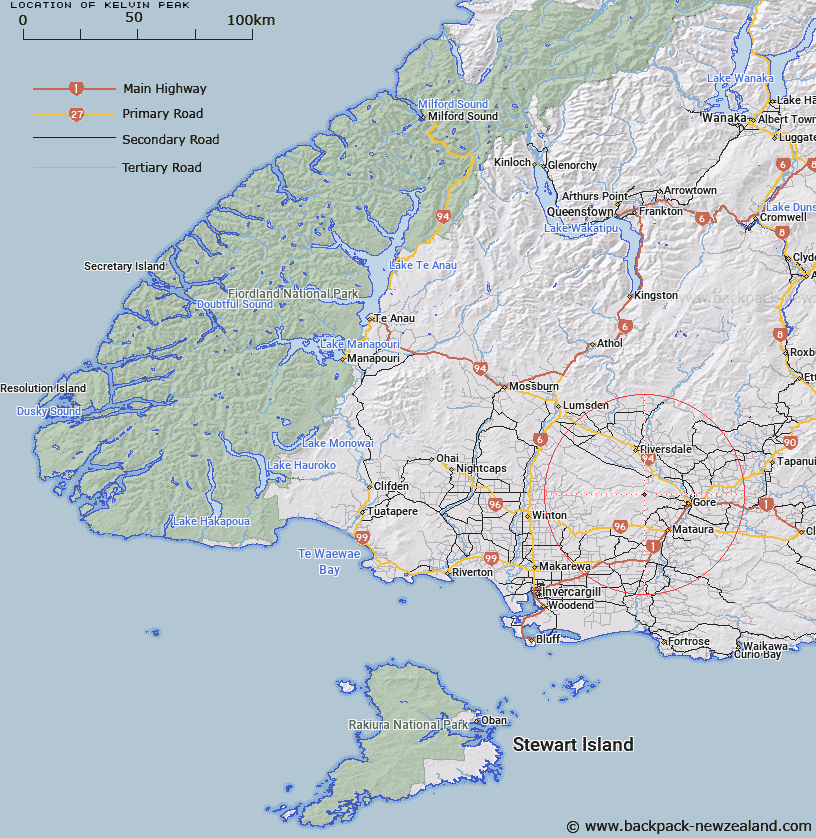
Map showing location of Kelvin Peak


LINZ description: Trig 1053 at 639m height in the Hokonui Hills south of Waterfall Range.
Latitude: -46.062661
Longitude: 168.773335
Northing: 4890300
Easting: 1273100
Land District: Southland
Feat Type: Trig Station


Scroll down to see a more detailed road map and below that a topographical map showing the location of Kelvin Peak. The road map has been supplied by openstreetmap and the topographical map of Kelvin Peak has been supplied by Land Information New Zealand (LINZ).

Yes you can use the top static map for you school/university project or personal website with a link back. Contact me for any commercial use.

Kelvin Peak Map New Zealand


New Zealand places in our database
[ A ] [ B ] [ C ] [ D ] [ E ] [ F ] [ G ] [ H ] [ I ] [ J ] [ K ] [ L ] [ M ] [ N ] [ O ] [ P ] [ Q ] [ R ] [ S ] [ T ] [ U ] [ V ] [ W ] [ X ] [ Y ] [ Z ]


Closest 20 Trig Stations to Kelvin Peak

Waiparu ( 29.37km )   Forest Hill ( 29.77km )   Mataura ( 40.6km )   Mokoreta ( 45.65km )   Toetoes ( 51.81km )   Gowan Hill ( 57.67km )   Fortrose ( 61.02km )   Glenomaru ( 78.13km )   Hyde Rock ( 81.9km )   North Taieri ( 123.93km )   Jeffrey ( 141.74km )   McArthny ( 149.92km )   Waikouaiti ( 155.09km )   Tor ( 159.94km )   Waihemo ( 161.6km )   The Rock ( 161.83km )   Obi ( 164.8km )   Moeraki ( 178.08km )   Kohurau ( 184.99km )   Kauru Hill ( 185.24km )   Kauroo Hill ( 185.24km )   Pentland Hill ( 224.01km )   Yellow Hill ( 224.01km )   Te Huruhuru ( 240.95km )   Chastleton ( 273.78km )   Coldstream ( 303.38km )   Rangitata ( 303.38km )   Rabbit Hill ( 326.95km )   Round Top ( 368.12km )   Tara ( 383.65km )   Koiterangi ( 394.34km )   Kowhitirangi ( 394.34km )   Tihiokahukura ( 414.08km )   Harris ( 419.23km )   Weka ( 460.43km )   Pahau ( 483.34km )   Mount Saul ( 495.89km )   Flintoff ( 496.75km )   Flintoft ( 496.75km )   Faerie Queene ( 517.05km )