Map showing location of Hunter River


LINZ description: Feature shown on: NZMS260 G38 Edition 1 1989
Latitude: -44.147239
Longitude: 169.534275
Northing: 5105931
Easting: 1322821.4
Land District: Otago
Feat Type: Stream


Scroll down to see a more detailed road map and below that a topographical map showing the location of Hunter River. The road map has been supplied by openstreetmap and the topographical map of Hunter River has been supplied by Land Information New Zealand (LINZ).

Yes you can use the top static map for you school/university project or personal website with a link back. Contact me for any commercial use.
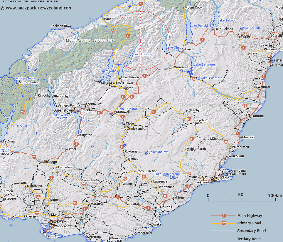
Hunter River Map New Zealand


New Zealand places in our database
[ A ] [ B ] [ C ] [ D ] [ E ] [ F ] [ G ] [ H ] [ I ] [ J ] [ K ] [ L ] [ M ] [ N ] [ O ] [ P ] [ Q ] [ R ] [ S ] [ T ] [ U ] [ V ] [ W ] [ X ] [ Y ] [ Z ]


Closest 20 Streams to Hunter River

Billy Creek ( 2.27km )   Scrubby Flat Creek ( 3.75km )   Bull Flat Creek ( 4.83km )   Long Flat Creek ( 5.28km )   Cotters Creek ( 6.64km )   Little Canyon Creek ( 7.95km )   Ferguson Creek ( 7.97km )   Canyon Creek ( 8.08km )   Wind Pudding Creek ( 8.64km )   Lake Creek ( 8.72km )   Green Gully Creek ( 10.78km )   Ahuriri River ( 11.6km )   Watson Stream ( 11.77km )   Tole Creek ( 11.94km )   Tote Creek ( 11.94km )   Connors Creek ( 12.15km )   Lodore Creek ( 12.54km )   Rabbit Creek ( 12.72km )   Cascade Creek ( 12.8km )   Fantail Creek ( 13.01km )   Dark Creek ( 13.22km )   Hodgkinson Creek ( 13.26km )   Brewster Creek ( 13.29km )   Pyke Creek ( 13.39km )   Fleming Creek ( 13.48km )   Lost Creek ( 13.63km )   Lily Creek ( 13.67km )   Zig Zag Creek ( 13.78km )   Safe Creek ( 13.78km )   Dukes Creek ( 13.82km )   Torrance Creek ( 13.88km )   Wills River ( 13.97km )   Stewarts Creek ( 14.08km )   Cascade Creek ( 14.14km )   Pansy Creek ( 14.19km )   Sweet Nell Creek ( 14.2km )   Easy Creek ( 14.48km )   Swift Creek ( 14.5km )   Shortcut Creek ( 14.51km )   Cheap Creek ( 14.51km )