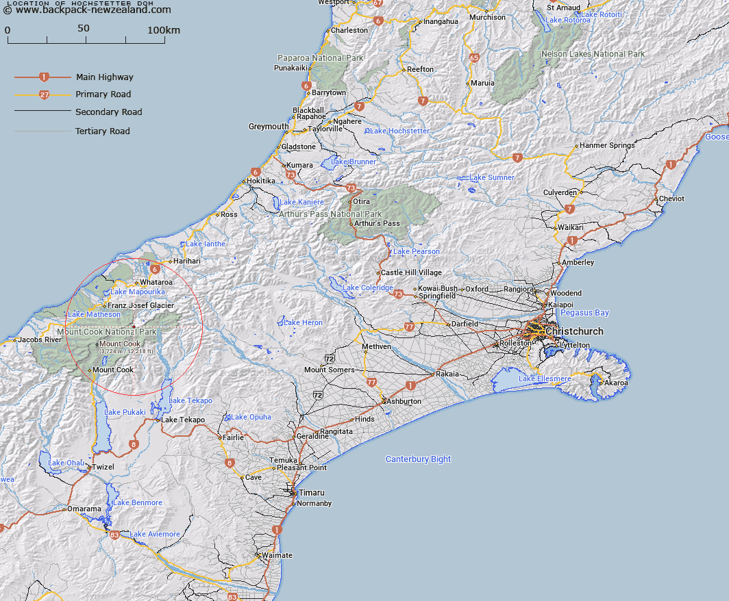
Map showing location of Hochstetter Dom


LINZ description: On the main divide at head of Tasman Glacier. Between Elie de Beaumont Peak and Mount Aylmer.
Latitude: -43.500811
Longitude: 170.347632
Northing: 5180150.8
Easting: 1385569.9
Land District: Canterbury, Westland
Feat Type: Hill


Scroll down to see a more detailed road map and below that a topographical map showing the location of Hochstetter Dom. The road map has been supplied by openstreetmap and the topographical map of Hochstetter Dom has been supplied by Land Information New Zealand (LINZ).

Yes you can use the top static map for you school/university project or personal website with a link back. Contact me for any commercial use.

Hochstetter Dom Map New Zealand


New Zealand places in our database
[ A ] [ B ] [ C ] [ D ] [ E ] [ F ] [ G ] [ H ] [ I ] [ J ] [ K ] [ L ] [ M ] [ N ] [ O ] [ P ] [ Q ] [ R ] [ S ] [ T ] [ U ] [ V ] [ W ] [ X ] [ Y ] [ Z ]


Closest 20 Hills to Hochstetter Dom

Mount Aylmer ( 1.32km )   Graceful Peak ( 1.97km )   Mount Walter ( 2.37km )   Mount Abel ( 2.57km )   Mount Elie De Beaumont ( 2.64km )   Mount Annan ( 2.9km )   Mount Green ( 2.96km )   Mount Darwin ( 2.98km )   Brodrick Peak ( 3.74km )   Mount Cooper ( 3.79km )   Roderick Peak ( 3.91km )   Coronet ( 3.99km )   Haeckel Peak ( 4.36km )   Mount Meeson ( 4.69km )   Mount Peter ( 4.77km )   Vic Mountain ( 5.09km )   Rose Peak ( 5.11km )   Mount Mannering ( 5.34km )   Mount Gold Smith ( 5.55km )   Mount Goldsmith ( 5.55km )   Mount Alec ( 5.68km )   Mount Turnbull ( 6.06km )   Minarets ( 6.06km )   Mount Hamilton ( 6.15km )   Coopers Mate ( 6.47km )   Mount Phyllis ( 6.49km )   Wilczek Peak ( 6.56km )   De La Beche ( 6.65km )   Mount Park ( 6.85km )   Park Peak ( 6.86km )   Matenga Peak ( 6.93km )   Rumdoodle ( 7.04km )   Mount Sidney King ( 7.07km )   Mount Sydney King ( 7.07km )   Mount Barrowman ( 7.33km )   Dog Kennel Peak ( 7.39km )   Neophyte Peak ( 7.45km )   Moonlight Peak ( 7.45km )   Mount Richmond ( 7.46km )   Mount Rudolf ( 7.64km )