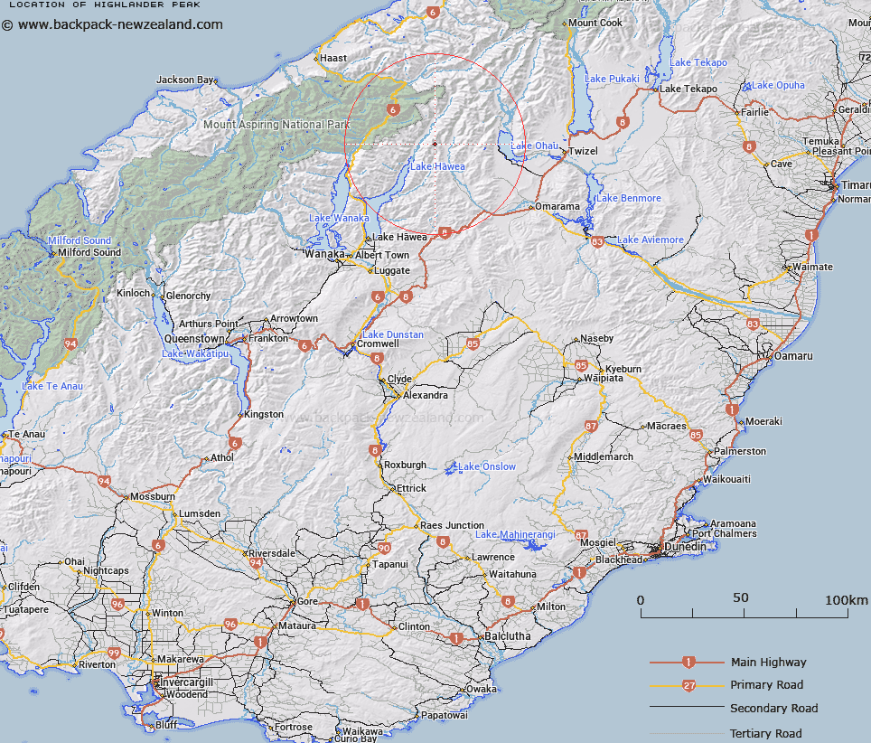
Map showing location of Highlander Peak


LINZ description: Peak at height 2285m in the Huxley Range at the head of the Dingle Burn.
Latitude: -44.227224
Longitude: 169.548092
Northing: 5097093
Easting: 1324300
Land District: Otago
Feat Type: Hill


Scroll down to see a more detailed road map and below that a topographical map showing the location of Highlander Peak. The road map has been supplied by openstreetmap and the topographical map of Highlander Peak has been supplied by Land Information New Zealand (LINZ).

Yes you can use the top static map for you school/university project or personal website with a link back. Contact me for any commercial use.

Highlander Peak Map New Zealand


New Zealand places in our database
[ A ] [ B ] [ C ] [ D ] [ E ] [ F ] [ G ] [ H ] [ I ] [ J ] [ K ] [ L ] [ M ] [ N ] [ O ] [ P ] [ Q ] [ R ] [ S ] [ T ] [ U ] [ V ] [ W ] [ X ] [ Y ] [ Z ]


Closest 20 Hills to Highlander Peak

Celtic Peak ( 1.73km )   Mount Rigel ( 4.78km )   Leaning Mount ( 5.62km )   Mount Heim ( 6.78km )   Mount Barth ( 8.71km )   Mount Saint Mary ( 9.17km )   Mount Gladwish ( 9.59km )   Tent Peak ( 9.96km )   Mount Stafford ( 10.94km )   Mount Peterson ( 11.28km )   Mount Calvin ( 11.54km )   Mount Arnold ( 12.12km )   Little Arnold ( 12.42km )   Mount Wyn Irwin ( 13.23km )   Puke Makariri ( 13.84km )   Mount Patriarch ( 14.22km )   Elusive Peak ( 14.73km )   Mount Maitland ( 14.98km )   Hiwiroa Mount ( 16.03km )   Paku Peak ( 16.36km )   Pinnacle ( 17.02km )   Birch Hill ( 17.28km )   Mount Sutton ( 17.48km )   Mount Armstrong ( 17.59km )   Armstrong Mountain ( 17.59km )   Mount Ferguson ( 17.6km )   Mount Kaye ( 17.63km )   Mount Jones ( 18.27km )   Chosspile Peaks ( 18.62km )   Stony Peak ( 18.66km )   Mount Wray ( 19.04km )   Mount Tole ( 19.14km )   Pakeke Peak ( 19.26km )   Mount Brewster ( 19.6km )   Mount Huxley ( 20.26km )   Ohau Peak ( 20.3km )   Topheavy ( 20.47km )   Ben Avon ( 21.02km )   Shingle Hill ( 21.06km )   Mount Shrimpton ( 21.17km )