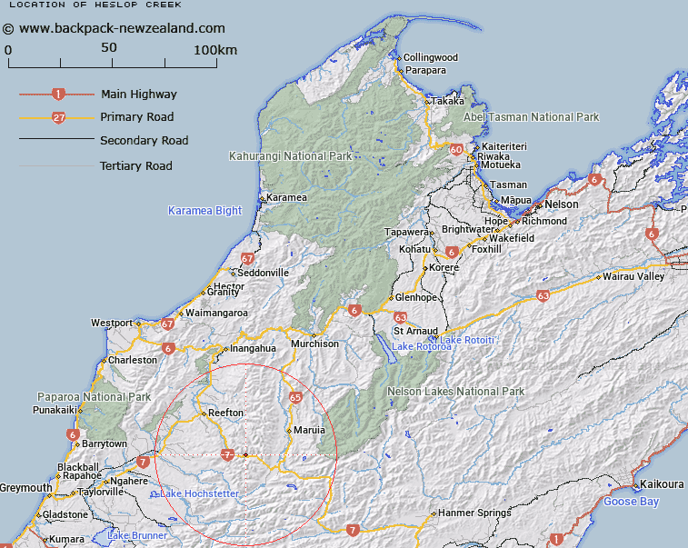
Map showing location of Heslop Creek
LINZ description: Right bank tributary of Inangahua River, rising on the South-east slope of Mount Penneal [Trig. 4612 (Geodetic Code A83D)], flowing southward and joining the Inangahua River near Trig. NA 65 (Geodetic Code B3TG). Block XII Waitahu Survey District.
Latitude: -42.283789
Longitude: 172.035898
Northing: 5318264.3
Easting: 1520510.7
Land District: Nelson
Feat Type: Stream
Latitude: -42.283789
Longitude: 172.035898
Northing: 5318264.3
Easting: 1520510.7
Land District: Nelson
Feat Type: Stream

Scroll down to see a more detailed road map and below that a topographical map showing the location of Heslop Creek. The road map has been supplied by openstreetmap and the topographical map of Heslop Creek has been supplied by Land Information New Zealand (LINZ).
Yes you can use the top static map for you school/university project or personal website with a link back. Contact me for any commercial use.
[ A ] [ B ] [ C ] [ D ] [ E ] [ F ] [ G ] [ H ] [ I ] [ J ] [ K ] [ L ] [ M ] [ N ] [ O ] [ P ] [ Q ] [ R ] [ S ] [ T ] [ U ] [ V ] [ W ] [ X ] [ Y ] [ Z ]