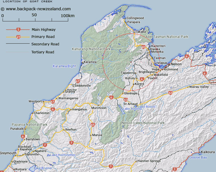
Map showing location of Goat Creek


LINZ description: Feature shown on: NZMS260 N27 Edition 1 1987; NZTopo50-BQ24 786333-813354
Latitude: -41.239623
Longitude: 172.76429
Northing: 5434615.1
Easting: 1580248.4
Land District: Nelson
Feat Type: Stream


Scroll down to see a more detailed road map and below that a topographical map showing the location of Goat Creek. The road map has been supplied by openstreetmap and the topographical map of Goat Creek has been supplied by Land Information New Zealand (LINZ).

Yes you can use the top static map for you school/university project or personal website with a link back. Contact me for any commercial use.
Goat Creek Map New Zealand


New Zealand places in our database
[ A ] [ B ] [ C ] [ D ] [ E ] [ F ] [ G ] [ H ] [ I ] [ J ] [ K ] [ L ] [ M ] [ N ] [ O ] [ P ] [ Q ] [ R ] [ S ] [ T ] [ U ] [ V ] [ W ] [ X ] [ Y ] [ Z ]


Closest 20 Streams to Goat Creek

Pearse River ( 1.45km )   Field Creek ( 2.02km )   Sugar Loaf Creek ( 2.24km )   Granity Creek ( 2.34km )   Price Creek ( 2.91km )   Eyles Creek ( 4.38km )   Whisky Creek ( 4.64km )   Graham River South Branch ( 4.66km )   Stony Creek ( 4.68km )   Motueka River ( 5.26km )   Graham River ( 6.57km )   Ellis River ( 6.61km )   Long Gully Stream ( 7.3km )   Quartz Creek ( 7.34km )   Hicky Creek ( 7.54km )   Horseshoe Creek ( 7.63km )   Holmwood Creek ( 7.8km )   Murray Stream ( 7.9km )   Bruce Creek ( 8.04km )   Lodestone Creek ( 8.15km )   Rocky Creek ( 8.24km )   Flora Stream ( 8.72km )   Little Pokororo River ( 8.89km )   Gridiron Creek ( 9.02km )   Saddle Creek ( 9.02km )   Baton River ( 9.09km )   Graham River North Branch ( 9.17km )   Eatwell Creek ( 9.19km )   Ernest Creek ( 9.26km )   Twins Creek ( 9.77km )   Hodge Creek ( 9.78km )   Hodges Creek ( 9.78km )   Loveridge Creek ( 10.19km )   Naylor Creek ( 10.25km )   Haines Stream ( 10.43km )   Growler Creek ( 10.68km )   Grecian Stream ( 10.97km )   Ghost Creek ( 11.19km )   Orinoco Creek ( 11.28km )   Sunday Valley Stream ( 11.33km )