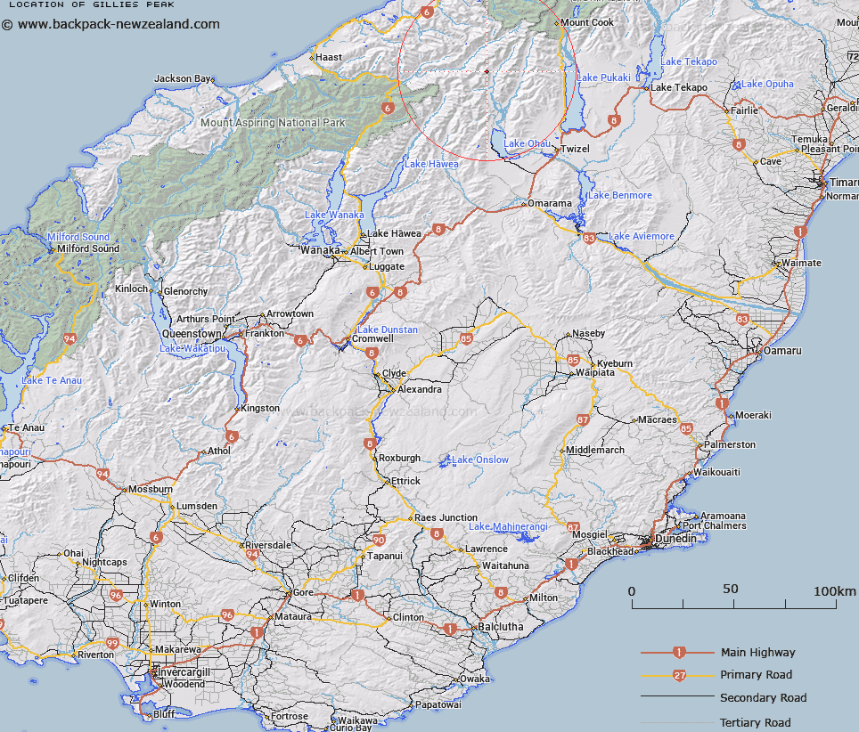
Map showing location of Gillies Peak


LINZ description: Peak 2177, south of Hut Peak, east of the Main Divide of the Southern Alps/Kā Tiritiri o te Moana.
Latitude: -43.934674
Longitude: 169.795147
Northing: 5130388.5
Easting: 1342766.8
Land District: Otago
Feat Type: Hill


Scroll down to see a more detailed road map and below that a topographical map showing the location of Gillies Peak. The road map has been supplied by openstreetmap and the topographical map of Gillies Peak has been supplied by Land Information New Zealand (LINZ).

Yes you can use the top static map for you school/university project or personal website with a link back. Contact me for any commercial use.

Gillies Peak Map New Zealand


New Zealand places in our database
[ A ] [ B ] [ C ] [ D ] [ E ] [ F ] [ G ] [ H ] [ I ] [ J ] [ K ] [ L ] [ M ] [ N ] [ O ] [ P ] [ Q ] [ R ] [ S ] [ T ] [ U ] [ V ] [ W ] [ X ] [ Y ] [ Z ]


Closest 20 Hills to Gillies Peak

Hut Peak ( 0.63km )   McNulty Peak ( 1.72km )   Taiaha Peak ( 2.5km )   Mount Fraser ( 2.99km )   Mount Dobson ( 3.36km )   Mount Kitson ( 3.62km )   Welch Peak ( 3.88km )   Mount Trent ( 4.01km )   Barron Peak ( 4.39km )   Mount Jackson ( 4.71km )   Mount Hickson ( 5.54km )   Mount McKenzie ( 5.95km )   Mount Mackenzie ( 5.95km )   Boanerges ( 5.98km )   Dasler Pinnacles ( 6.46km )   Baker Peak ( 7.03km )   Mount Glencairn ( 7.12km )   Mount Dundas ( 7.36km )   Mount Glenisla ( 7.46km )   Mount Glenmary ( 8.1km )   Mount Ward ( 8.2km )   Mount Strauchon ( 8.44km )   Ben Ross ( 9.1km )   Mount Clarke ( 9.54km )   Mount Clark ( 9.54km )   Armistice Peak ( 9.75km )   Mount Wilson ( 10.37km )   Mount Marchant ( 10.47km )   Anita Peak ( 11.16km )   Mount Browning ( 11.49km )   Adams Peak ( 12.09km )   Mount Solution ( 12.38km )   Mount Reticence ( 12.69km )   Mount Gow ( 12.69km )   Rabbiters Peak ( 12.74km )   Mount Nihokohatu ( 12.78km )   Mount Baker ( 12.78km )   Mount Giles ( 12.93km )   Snow Top ( 12.97km )   Mount Glen Lyon ( 13.05km )