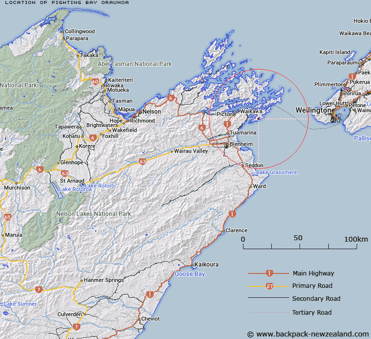
Map showing location of Fighting Bay (Oraumoa)


LINZ description: A bay east of Te Whanganui / Port Underwood approximately 17km east south-east of Picton. NZTopo50-BQ29 005250.
Latitude: -41.3211
Longitude: 174.202014
Northing: 5424900
Easting: 1700600
Land District: Marlborough
Feat Type: Bay


Scroll down to see a more detailed road map and below that a topographical map showing the location of Fighting Bay (Oraumoa). The road map has been supplied by openstreetmap and the topographical map of Fighting Bay (Oraumoa) has been supplied by Land Information New Zealand (LINZ).

Yes you can use the top static map for you school/university project or personal website with a link back. Contact me for any commercial use.

Fighting Bay (Oraumoa) Map New Zealand


New Zealand places in our database
[ A ] [ B ] [ C ] [ D ] [ E ] [ F ] [ G ] [ H ] [ I ] [ J ] [ K ] [ L ] [ M ] [ N ] [ O ] [ P ] [ Q ] [ R ] [ S ] [ T ] [ U ] [ V ] [ W ] [ X ] [ Y ] [ Z ]


Closest 20 Bays to Fighting Bay (Oraumoa)

Tumbledown Bay ( 2.43km )   Jerdans Bay ( 2.75km )   Kanae Bay ( 2.83km )   Hakana Bay ( 3.4km )   Whataroa Bay ( 3.79km )   Ngakuta Bay ( 4.16km )   Island Bay ( 4.19km )   Glasgow Bay ( 4.19km )   Kaikoura Bay ( 4.45km )   Karaka Bay ( 4.62km )   Whangakoko Bay ( 4.8km )   Tongue Bay ( 5.03km )   Pipi Bay ( 5.41km )   Opua Bay ( 5.48km )   Deep Bight ( 5.62km )   Whangatoetoe Bay ( 5.75km )   Missionary Bay ( 5.78km )   Kingfish Bay ( 5.93km )   Opihi Bay ( 6.14km )   Tawa Bay ( 6.2km )   Cutters Bay ( 6.63km )   Whangataura Bay ( 6.77km )   Uruti Bay ( 6.95km )   Te Whanganui / Port Underwood ( 7.12km )   Port Underwood ( 7.12km )   Waingaro Bay ( 7.32km )   Coles Bay ( 7.32km )   Oyster Bay ( 7.54km )   Tom Canes Bay ( 7.61km )   Hakahaka Bay ( 7.62km )   Hitaua Bay ( 7.79km )   Kakapo Bay ( 7.88km )   Erie Bay ( 7.88km )   Waipuna Bay ( 7.93km )   Te Weka Bay ( 8.38km )   Te Weuweu Bay ( 8.45km )   Ocean Bay ( 8.55km )   Te Pangu Bay ( 8.68km )   Maraetai Bay ( 8.99km )   Konini Bay ( 9.21km )