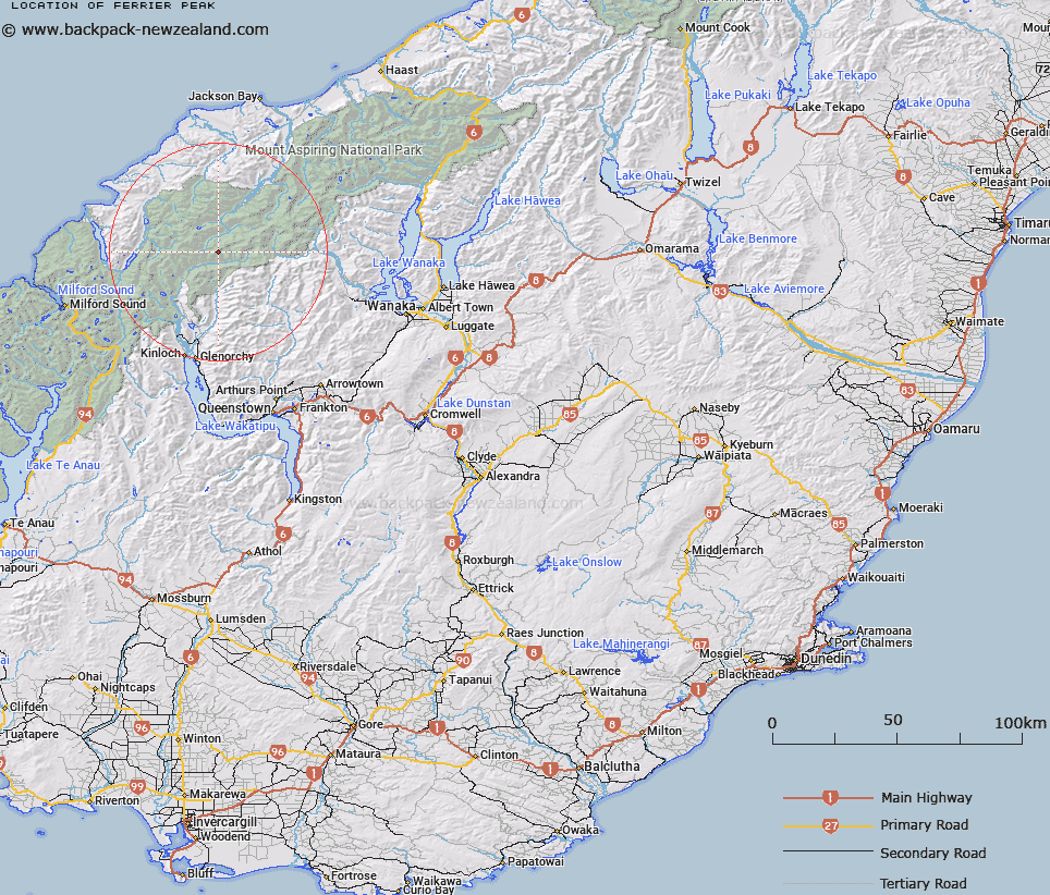
Map showing location of Ferrier Peak


LINZ description: Peak on the Main Divide, south-west of Mount Ian, above the Hamilton and Curzon Glaciers in the Snowdrift Range.
Latitude: -44.491681
Longitude: 168.467841
Northing: 5063516.2
Easting: 1239645.4
Land District: Otago
Feat Type: Hill


Scroll down to see a more detailed road map and below that a topographical map showing the location of Ferrier Peak. The road map has been supplied by openstreetmap and the topographical map of Ferrier Peak has been supplied by Land Information New Zealand (LINZ).

Yes you can use the top static map for you school/university project or personal website with a link back. Contact me for any commercial use.

Ferrier Peak Map New Zealand


New Zealand places in our database
[ A ] [ B ] [ C ] [ D ] [ E ] [ F ] [ G ] [ H ] [ I ] [ J ] [ K ] [ L ] [ M ] [ N ] [ O ] [ P ] [ Q ] [ R ] [ S ] [ T ] [ U ] [ V ] [ W ] [ X ] [ Y ] [ Z ]


Closest 20 Hills to Ferrier Peak

Bernard Peak ( 0.59km )   Mount Ian ( 1.01km )   Mount Victoria ( 2.13km )   Mount Tiber ( 2.14km )   Frobisher Mountain ( 3.08km )   Mount Amundsen ( 3.16km )   Key Dome ( 3.29km )   Mount Peary ( 3.61km )   Mount Lydia ( 4.18km )   Chancellor ( 4.39km )   Nansen Peak ( 5.1km )   The Snowman Peak ( 6.38km )   Alpha Mountain ( 6.48km )   Mount Clarke ( 6.74km )   Osonzac Twins ( 6.77km )   Mount Beta ( 6.78km )   Johansen Peak ( 6.83km )   Mount Troas ( 6.98km )   Gamma Mountain ( 7.09km )   Ellie Peak ( 7.16km )   Humboldt Tower ( 7.16km )   Delta Mountain ( 7.48km )   Moira Peak ( 7.49km )   Mount Head ( 7.82km )   Marion Tower ( 7.93km )   Destiny Peak ( 7.97km )   Daedelus ( 8.07km )   Mount Cunningham ( 8.14km )   Buttress ( 8.24km )   Stefansson Peak ( 8.44km )   Passchendaele Peak ( 8.49km )   Watkins ( 8.66km )   Pyramid ( 8.67km )   Climax Peak ( 9.02km )   Head Peak ( 9.19km )   Pivot Peak ( 9.22km )   Camp Oven Dome ( 9.22km )   Gable Peak ( 9.23km )   Five Fingers ( 9.34km )   Gino Peak ( 9.43km )