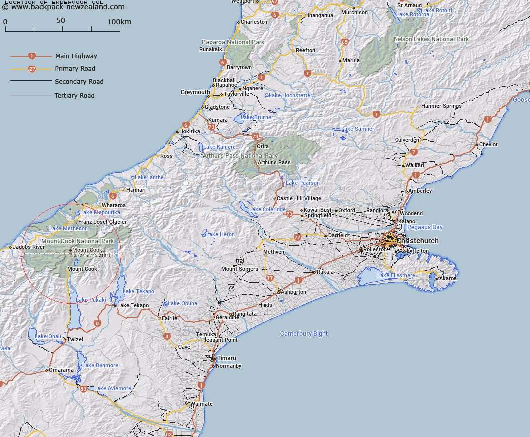
Map showing location of Endeavour Col


LINZ description: Cook and Mueller Survey Districts. Between Nazomi Peak and the third peak of Mount Cook
Latitude: -43.617586
Longitude: 170.143717
Northing: 5166635.1
Easting: 1369529.6
Land District: Canterbury
Feat Type: Pass


Scroll down to see a more detailed road map and below that a topographical map showing the location of Endeavour Col. The road map has been supplied by openstreetmap and the topographical map of Endeavour Col has been supplied by Land Information New Zealand (LINZ).

Yes you can use the top static map for you school/university project or personal website with a link back. Contact me for any commercial use.

Endeavour Col Map New Zealand


New Zealand places in our database
[ A ] [ B ] [ C ] [ D ] [ E ] [ F ] [ G ] [ H ] [ I ] [ J ] [ K ] [ L ] [ M ] [ N ] [ O ] [ P ] [ Q ] [ R ] [ S ] [ T ] [ U ] [ V ] [ W ] [ X ] [ Y ] [ Z ]


Closest 20 Passs to Endeavour Col

Endeavour Col ( 0km )   Porter Col ( 1.23km )   Proud Pass ( 2.12km )   Cinerama Col ( 2.53km )   Ball Pass ( 2.91km )   Green Saddle ( 2.98km )   Harper Saddle ( 3.77km )   Baker Saddle ( 3.79km )   Clarke Saddle ( 4.61km )   Copland Pass ( 5.68km )   Fitzgerald Pass ( 6.17km )   Engineer Col ( 6.45km )   Engineer Pass ( 6.48km )   Marcel Pass ( 6.85km )   Cuttance Col ( 6.99km )   Pioneer Pass ( 7.25km )   Katies Col ( 7.32km )   Billiken Pass ( 7.71km )   Governor Col ( 7.9km )   Darkwater Saddle ( 9.69km )   Tuckett Col ( 10.22km )   Frenchay Col ( 11.32km )   West Hoe Pass ( 11.93km )   Newton Pass ( 12.05km )   Karangarua Pass ( 12.39km )   Welcome Pass ( 12.39km )   Abbey Pass ( 12.65km )   Halcombe Col ( 12.95km )   Brunner Col ( 13.15km )   Malte Brun Pass ( 13.22km )   Zurbriggen Col ( 14.48km )   Zubriggen Col ( 14.48km )   Waihi Pass ( 14.82km )   Lucy Walker Pass ( 14.97km )   Jollie Saddle ( 15.06km )   Graham Saddle ( 15.08km )   Ailsa Pass ( 15.21km )   Twain Col ( 15.42km )   Whales Saddle ( 15.56km )   Cow Block Saddle ( 16.05km )