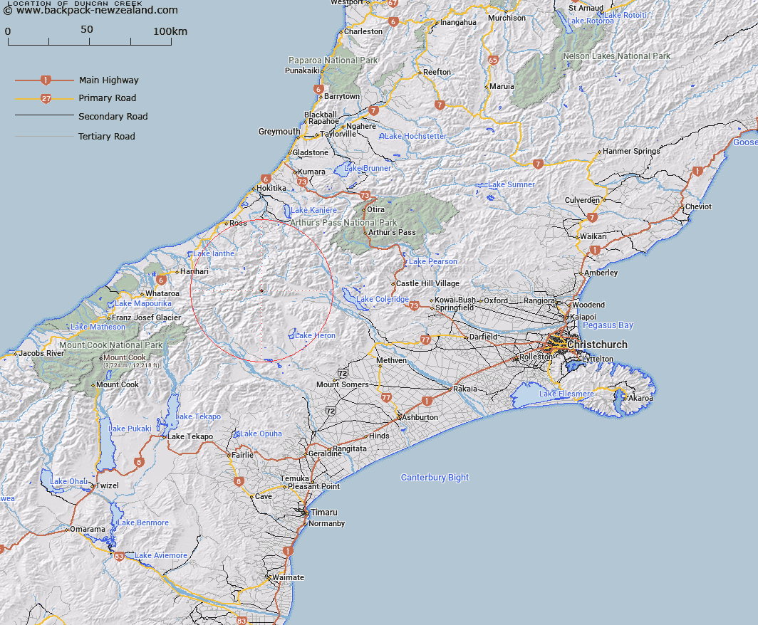
Map showing location of Duncan Creek


LINZ description: Tributary of Rakaia River, entering the Rakaia on the left bank between Lauper Stream and Cattle Stream. Whitcombe Survey District.
Latitude: -43.246306
Longitude: 171.008889
Northing: 5209908
Easting: 1438355.5
Land District: Canterbury
Feat Type: Stream


Scroll down to see a more detailed road map and below that a topographical map showing the location of Duncan Creek. The road map has been supplied by openstreetmap and the topographical map of Duncan Creek has been supplied by Land Information New Zealand (LINZ).

Yes you can use the top static map for you school/university project or personal website with a link back. Contact me for any commercial use.

Duncan Creek Map New Zealand


New Zealand places in our database
[ A ] [ B ] [ C ] [ D ] [ E ] [ F ] [ G ] [ H ] [ I ] [ J ] [ K ] [ L ] [ M ] [ N ] [ O ] [ P ] [ Q ] [ R ] [ S ] [ T ] [ U ] [ V ] [ W ] [ X ] [ Y ] [ Z ]


Closest 20 Streams to Duncan Creek

Cattle Stream ( 2.93km )   Bull Spur Stream ( 4.62km )   Totara Stream ( 4.83km )   Louper Stream ( 4.96km )   Lauper Stream ( 4.96km )   Dean Stream ( 5.08km )   Molar Stream ( 5.43km )   Cap Creek ( 5.46km )   Whitcombe River ( 5.76km )   Scandret Creek ( 6.01km )   Snag Creek ( 6.61km )   Cairn Creek ( 6.61km )   Gateway Creek ( 6.97km )   Jagged Stream ( 7.34km )   Neave Creek ( 7.37km )   Reischek Stream ( 7.86km )   Diorite Creek ( 8.07km )   Jourdain Creek ( 8.67km )   South Mathias River ( 8.71km )   Wilkinson River ( 9.09km )   Jellicoe Stream ( 9.24km )   Jerusalem Stream ( 9.37km )   Sharpes Cascade ( 9.53km )   Morley Creek ( 9.94km )   Walcott Creek ( 10.16km )   Rocky Spur Creek ( 10.16km )   Seddon Creek ( 10.24km )   Hut Stream ( 10.24km )   Crack Creek ( 10.3km )   Washbourne Creek ( 10.31km )   Bond Creek ( 10.61km )   Twin Creek ( 11.6km )   Chairmans Creek ( 11.88km )   Vane Stream ( 12.24km )   Evans River ( 12.34km )   Smyth Creek ( 12.39km )   McWhirter Creek ( 12.55km )   West Mathias River ( 12.9km )   Broad Creek ( 13.54km )   Big Paddock Creek ( 13.61km )