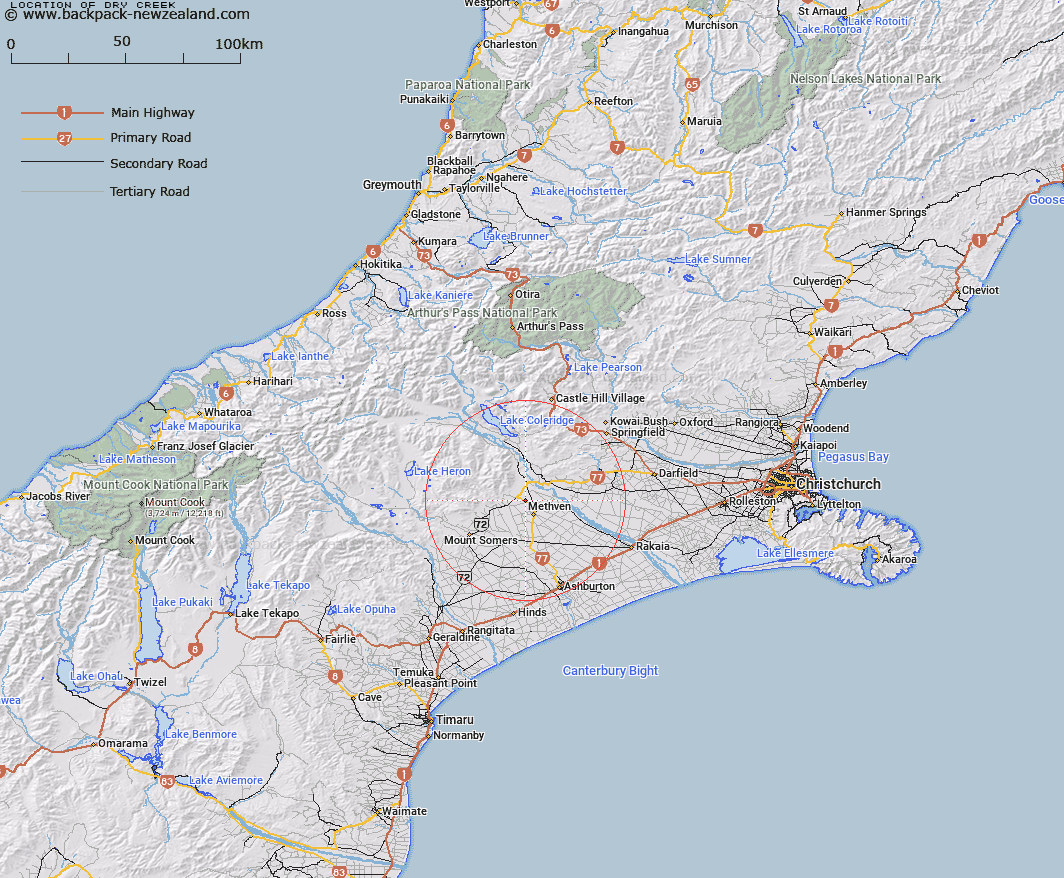
Map showing location of Dry Creek


LINZ description: Stream flowing from Mt Hutt past the north of Methven
Latitude: -43.585512
Longitude: 171.615022
Northing: 5173230
Easting: 1488190
Land District: Canterbury
Feat Type: Stream


Scroll down to see a more detailed road map and below that a topographical map showing the location of Dry Creek. The road map has been supplied by openstreetmap and the topographical map of Dry Creek has been supplied by Land Information New Zealand (LINZ).

Yes you can use the top static map for you school/university project or personal website with a link back. Contact me for any commercial use.

Dry Creek Map New Zealand


New Zealand places in our database
[ A ] [ B ] [ C ] [ D ] [ E ] [ F ] [ G ] [ H ] [ I ] [ J ] [ K ] [ L ] [ M ] [ N ] [ O ] [ P ] [ Q ] [ R ] [ S ] [ T ] [ U ] [ V ] [ W ] [ X ] [ Y ] [ Z ]


Closest 20 Streams to Dry Creek

Rakaia River ( 8.74km )   Five Mile Creek ( 11.7km )   Campbells Stream ( 12.35km )   Pudding Hill Stream ( 12.8km )   Boundary Stream ( 12.97km )   Diamond Creek ( 13.08km )   Washpen Creek ( 13.74km )   Waterfall Creek ( 14.51km )   Staveley Stream ( 14.72km )   Hutt Creek ( 14.77km )   Grahams Creek ( 14.8km )   Little River ( 14.88km )   Picnic Creek ( 14.9km )   The Mill Creek ( 15.43km )   McLennan Creek ( 15.9km )   Flynn Stream ( 15.97km )   Rockwood Stream ( 16.4km )   Boundary Stream ( 16.43km )   Ribbonwood Stream ( 16.58km )   Pony Stream ( 16.83km )   Diggers Creek ( 16.88km )   Hororata River ( 17.5km )   Snowy Stream ( 17.83km )   Bowyers Stream ( 17.84km )   Ford Stream ( 17.92km )   Copper Stream ( 18.09km )   Hutt Stream ( 18.28km )   Reid Stream ( 18.38km )   Swift River ( 18.55km )   Tinstone Creek ( 18.69km )   O'Shea Creek ( 19.08km )   Stevenson Stream ( 19.22km )   Caves Stream ( 19.81km )   Furze Stream ( 20km )   Dry Acheron Stream ( 20km )   Middle Creek ( 20.08km )   Buccleuch Stream ( 20.08km )   Harding Creek ( 20.34km )   Hall Stream ( 20.36km )   Buccleugh Stream ( 20.59km )