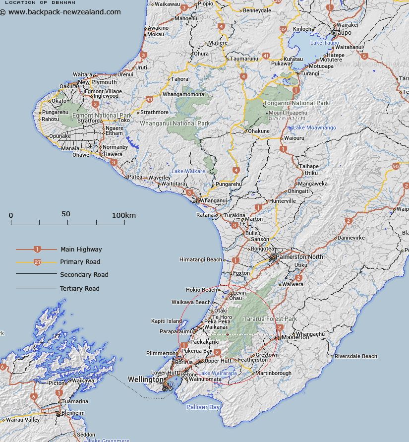
Map showing location of Dennan


LINZ description: A trig on Dennan peak at the head of Rae Ridge, south of the Otaki River in the Tararua Range.
Latitude: -40.925016
Longitude: 175.263654
Northing: 5467099.8
Easting: 1790599.5
Land District: Wellington
Feat Type: Trig Station


Scroll down to see a more detailed road map and below that a topographical map showing the location of Dennan. The road map has been supplied by openstreetmap and the topographical map of Dennan has been supplied by Land Information New Zealand (LINZ).

Yes you can use the top static map for you school/university project or personal website with a link back. Contact me for any commercial use.

Dennan Map New Zealand


New Zealand places in our database
[ A ] [ B ] [ C ] [ D ] [ E ] [ F ] [ G ] [ H ] [ I ] [ J ] [ K ] [ L ] [ M ] [ N ] [ O ] [ P ] [ Q ] [ R ] [ S ] [ T ] [ U ] [ V ] [ W ] [ X ] [ Y ] [ Z ]


Closest 20 Trig Stations to Dennan

Tauwharenikau ( 13.87km )   Tauherenikau ( 13.87km )   Mangatarere ( 19.58km )   Kaitoke ( 21.47km )   Mangaroa ( 21.47km )   Tunnel ( 21.47km )   Koromakau ( 22.36km )   Koromikau ( 22.36km )   Wainui (Whareroa) ( 24.14km )   Whareroa ( 24.14km )   Mangaroa ( 25.3km )   Whakapapa ( 26.67km )   Wakapapa ( 26.67km )   Mount Dundas ( 27.09km )   Pukemoremore ( 29.37km )   Tuteremoana ( 30.5km )   Ruapai ( 33.06km )   Ruapae ( 33.06km )   Bawbaw ( 34.33km )   Ngapuketurua ( 35.39km )   Ngapuketarua ( 35.39km )   Wairongomai ( 38.87km )   Waiorongomai ( 38.87km )   Wairongoma ( 38.87km )   Taramia ( 40.72km )   Taramea ( 40.72km )   Pariwhaririki ( 43.69km )   Pariwhariki ( 43.69km )   Oruarongo ( 48.07km )   Puketea ( 48.75km )   Pukeatea ( 48.75km )   Ngahauranga ( 51.79km )   Ngauranga ( 51.79km )   Rangoon Heights ( 52.45km )   Mount Misery ( 52.45km )   Te Maunga ( 53.04km )   Waimanga South ( 53.08km )   Waimangu South ( 53.08km )   Whakapuni ( 53.17km )   Wakapuni ( 53.17km )