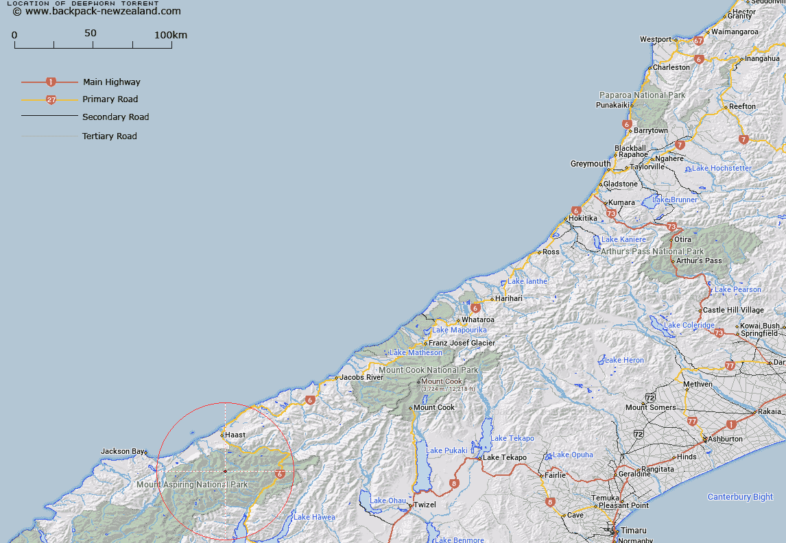
Map showing location of Deepworn Torrent


LINZ description: Feature shown on: NZMS260 F38 Edition 1 1995
Latitude: -44.074833
Longitude: 169.05975
Northing: 5112262.8
Easting: 1284483
Land District: Westland
Feat Type: Stream


Scroll down to see a more detailed road map and below that a topographical map showing the location of Deepworn Torrent. The road map has been supplied by openstreetmap and the topographical map of Deepworn Torrent has been supplied by Land Information New Zealand (LINZ).

Yes you can use the top static map for you school/university project or personal website with a link back. Contact me for any commercial use.
Deepworn Torrent Map New Zealand


New Zealand places in our database
[ A ] [ B ] [ C ] [ D ] [ E ] [ F ] [ G ] [ H ] [ I ] [ J ] [ K ] [ L ] [ M ] [ N ] [ O ] [ P ] [ Q ] [ R ] [ S ] [ T ] [ U ] [ V ] [ W ] [ X ] [ Y ] [ Z ]


Closest 20 Streams to Deepworn Torrent

Ngatau River ( 1.98km )   Twinkle Brook ( 1.98km )   Shale Stream ( 2.24km )   Flicker Creek ( 2.42km )   Lightning Creek ( 2.8km )   Shiver Creek ( 2.84km )   Accident Creek ( 3.37km )   Tinkle Rill ( 3.43km )   Whirlwind Water ( 3.77km )   Cramp Creek ( 3.99km )   Franklin Creek ( 4.01km )   Turnback Torrent ( 4.51km )   Abandon Brook ( 4.72km )   Stormy Rivulet ( 4.88km )   Ultima Creek ( 4.96km )   Repulse Creek ( 5.01km )   Dernier Torrent ( 5.28km )   Commotion Creek ( 5.3km )   Chilly Creek ( 5.43km )   Cache Stream ( 5.53km )   Meteor Torrent ( 5.76km )   Waterfall Creek ( 6.56km )   Adieu Creek ( 6.79km )   Io or Ossify Creek ( 7.63km )   Atom Creek ( 7.88km )   Katie Creek ( 7.91km )   Swift Water ( 7.96km )   Turmoil Torrent ( 8km )   Lindsay Creek ( 8.09km )   Chatter Creek ( 8.18km )   Emily Creek ( 8.42km )   Taken -a- Back Creek ( 8.46km )   Arcade Creek ( 8.54km )   Retreat Rivulet ( 8.68km )   Welcome Water ( 8.71km )   Betsy Jane Creek ( 8.71km )   Chlorite Creek ( 8.72km )   Blacksmith Torrent ( 8.73km )   Shining Water ( 9.07km )   Ease Down Creek ( 9.18km )