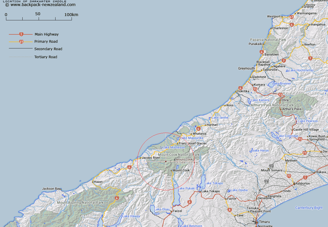
Map showing location of Darkwater Saddle


LINZ description: Mountain saddle on the Aurora Range which forms the source of Darkwater Stream, 1.1km North-east Price Peak. Block XIII Mount Cook Survey District.
Latitude: -43.617204
Longitude: 170.023315
Northing: 5166336
Easting: 1359812.6
Land District: Westland
Feat Type: Pass


Scroll down to see a more detailed road map and below that a topographical map showing the location of Darkwater Saddle. The road map has been supplied by openstreetmap and the topographical map of Darkwater Saddle has been supplied by Land Information New Zealand (LINZ).

Yes you can use the top static map for you school/university project or personal website with a link back. Contact me for any commercial use.

Darkwater Saddle Map New Zealand


New Zealand places in our database
[ A ] [ B ] [ C ] [ D ] [ E ] [ F ] [ G ] [ H ] [ I ] [ J ] [ K ] [ L ] [ M ] [ N ] [ O ] [ P ] [ Q ] [ R ] [ S ] [ T ] [ U ] [ V ] [ W ] [ X ] [ Y ] [ Z ]


Closest 20 Passs to Darkwater Saddle

Cuttance Col ( 3.08km )   Baker Saddle ( 6.01km )   Welcome Pass ( 6.48km )   Karangarua Pass ( 6.48km )   Whales Saddle ( 6.92km )   Copland Pass ( 7km )   Fitzgerald Pass ( 7.16km )   Tuckett Col ( 7.37km )   Lucy Walker Pass ( 7.49km )   New Year Pass ( 7.94km )   Harper Saddle ( 8.37km )   Wicks Col ( 8.57km )   Brunner Col ( 9.29km )   Porter Col ( 9.63km )   Endeavour Col ( 9.69km )   Green Saddle ( 9.91km )   Proud Pass ( 10.19km )   Ball Pass ( 10.68km )   Clarke Saddle ( 10.91km )   Katies Col ( 11.65km )   Cinerama Col ( 11.75km )   Billiken Pass ( 11.88km )   Waka Mara ( 11.91km )   Twain Col ( 12.16km )   Douglas Pass ( 12.29km )   Red Deer Col ( 12.67km )   Engineer Col ( 13.07km )   Engineer Pass ( 13.11km )   Waihi Pass ( 13.62km )   Marcel Pass ( 13.76km )   Christopher Col ( 13.9km )   Karangarua Saddle ( 14.19km )   Bernard Col ( 14.46km )   Pioneer Pass ( 14.48km )   Governor Col ( 15.17km )   Fyfe Pass ( 15.75km )   Hardies Gut ( 15.93km )   Sladden Saddle ( 16.18km )   Barron Saddle ( 16.18km )   Barrow Col ( 16.23km )