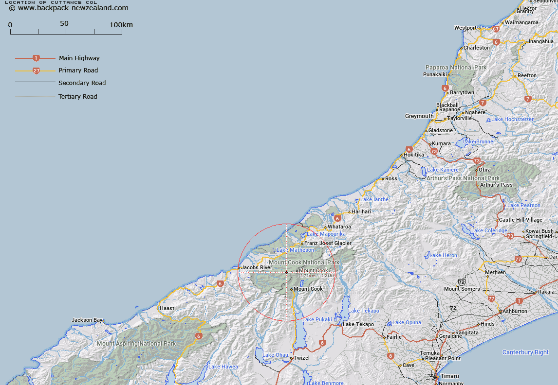
Map showing location of Cuttance Col


LINZ description: Shallow depression on Navigator Range 2.7km east of Mount Copland. Mount Cook Survey District.
Latitude: -43.606062
Longitude: 170.058381
Northing: 5167674.4
Easting: 1362598.3
Land District: Westland
Feat Type: Pass


Scroll down to see a more detailed road map and below that a topographical map showing the location of Cuttance Col. The road map has been supplied by openstreetmap and the topographical map of Cuttance Col has been supplied by Land Information New Zealand (LINZ).

Yes you can use the top static map for you school/university project or personal website with a link back. Contact me for any commercial use.

Cuttance Col Map New Zealand


New Zealand places in our database
[ A ] [ B ] [ C ] [ D ] [ E ] [ F ] [ G ] [ H ] [ I ] [ J ] [ K ] [ L ] [ M ] [ N ] [ O ] [ P ] [ Q ] [ R ] [ S ] [ T ] [ U ] [ V ] [ W ] [ X ] [ Y ] [ Z ]


Closest 20 Passs to Cuttance Col

Cuttance Col ( 0km )   Darkwater Saddle ( 3.08km )   Baker Saddle ( 3.2km )   Harper Saddle ( 5.29km )   Copland Pass ( 6.04km )   Fitzgerald Pass ( 6.41km )   Porter Col ( 6.74km )   Green Saddle ( 6.85km )   Endeavour Col ( 6.99km )   Clarke Saddle ( 7.82km )   Proud Pass ( 7.9km )   Tuckett Col ( 8.29km )   Welcome Pass ( 8.52km )   Karangarua Pass ( 8.52km )   Ball Pass ( 8.53km )   Whales Saddle ( 8.66km )   Katies Col ( 8.7km )   Cinerama Col ( 8.82km )   Engineer Col ( 10km )   Engineer Pass ( 10.04km )   Lucy Walker Pass ( 10.16km )   Marcel Pass ( 10.69km )   Brunner Col ( 10.82km )   Billiken Pass ( 10.9km )   New Year Pass ( 10.97km )   Pioneer Pass ( 11.4km )   Wicks Col ( 11.42km )   Governor Col ( 12.09km )   Twain Col ( 13.66km )   Waka Mara ( 14.38km )   Waihi Pass ( 14.52km )   Douglas Pass ( 14.6km )   Newton Pass ( 14.83km )   West Hoe Pass ( 14.9km )   Halcombe Col ( 15.13km )   Frenchay Col ( 15.34km )   Red Deer Col ( 15.51km )   Christopher Col ( 15.7km )   Zubriggen Col ( 16.03km )   Zurbriggen Col ( 16.03km )