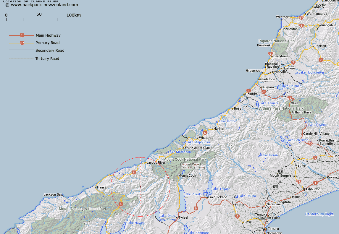
Map showing location of Clarke River


LINZ description: Significant river, west of the main divide and east of Haast, flowing south-west from its source above Marks Flat, in the Mount Hooker and Mount Gow watershed, into Landsborough River.
Latitude: -43.872169
Longitude: 169.618367
Northing: 5136764.5
Easting: 1328292.8
Land District: Westland
Feat Type: Stream


Scroll down to see a more detailed road map and below that a topographical map showing the location of Clarke River. The road map has been supplied by openstreetmap and the topographical map of Clarke River has been supplied by Land Information New Zealand (LINZ).

Yes you can use the top static map for you school/university project or personal website with a link back. Contact me for any commercial use.

Clarke River Map New Zealand


New Zealand places in our database
[ A ] [ B ] [ C ] [ D ] [ E ] [ F ] [ G ] [ H ] [ I ] [ J ] [ K ] [ L ] [ M ] [ N ] [ O ] [ P ] [ Q ] [ R ] [ S ] [ T ] [ U ] [ V ] [ W ] [ X ] [ Y ] [ Z ]


Closest 20 Streams to Clarke River

Murdock Creek ( 1.99km )   Saddle Creek ( 2.11km )   McCullaugh Creek ( 2.15km )   Buffers Creek ( 2.19km )   Davies Creek ( 2.33km )   Jack Creek ( 3.08km )   Rough Creek ( 4.82km )   Solution Creek ( 5.25km )   Adams Creek ( 5.74km )   Landslip Creek ( 6.43km )   Larson Creek ( 7.23km )   Tunnel Creek ( 7.5km )   Zeilian Creek ( 8.44km )   Wilson Creek ( 8.62km )   Fraser Creek ( 8.94km )   Jack Creek ( 9.15km )   Weary Creek ( 9.41km )   Millington Creek ( 9.47km )   Barron Creek ( 9.66km )   Harker Torrent ( 9.99km )   Mackenzie Creek ( 10.38km )   McKenzie Creek ( 10.38km )   Pass Creek ( 10.38km )   Dobson Creek ( 10.39km )   Landsborough River ( 10.55km )   Jackson Creek ( 10.82km )   Low Creek ( 10.97km )   McLennan Creek ( 11.03km )   Kea Stream ( 11.71km )   Border Creek ( 11.89km )   Two Eye Stream ( 12.34km )   Birch Creek ( 13.03km )   McKerrow Creek ( 13.54km )   Quarry Creek ( 13.73km )   South Elcho Stream ( 13.87km )   Dechen Creek ( 13.89km )   Hunter River East Branch ( 13.9km )   Otoko River ( 13.92km )   Hunter River West Branch ( 14.28km )   Huxley River North Branch ( 14.44km )