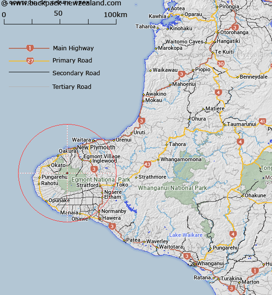
Map showing location of Carex Peak


LINZ description: Egmont National Park, North-West Egmont, Pouakai Range. On highest point of spur running from Bell Falls toward Pouakai Trig. 4,387 ft
Latitude: -39.24398
Longitude: 174.025872
Northing: 5655646.7
Easting: 1688527.1
Land District: Taranaki
Feat Type: Hill


Scroll down to see a more detailed road map and below that a topographical map showing the location of Carex Peak. The road map has been supplied by openstreetmap and the topographical map of Carex Peak has been supplied by Land Information New Zealand (LINZ).

Yes you can use the top static map for you school/university project or personal website with a link back. Contact me for any commercial use.

Carex Peak Map New Zealand


New Zealand places in our database
[ A ] [ B ] [ C ] [ D ] [ E ] [ F ] [ G ] [ H ] [ I ] [ J ] [ K ] [ L ] [ M ] [ N ] [ O ] [ P ] [ Q ] [ R ] [ S ] [ T ] [ U ] [ V ] [ W ] [ X ] [ Y ] [ Z ]


Closest 20 Hills to Carex Peak

Hump ( 1.04km )   Pouakai ( 1.26km )   Kiri Peak ( 1.58km )   The Dome ( 2.46km )   Maude Peak ( 2.69km )   Henry Peak ( 3km )   Hook Hill ( 3.58km )   Skinner Hill ( 4.24km )   Rata ( 4.65km )   Little Pyramid ( 4.86km )   Big Pyramid ( 4.94km )   Puniho Hill ( 5.43km )   Turehu Hill ( 5.69km )   Kahui Hill ( 5.74km )   Maru ( 6.04km )   Skeet Slide ( 6.26km )   Humphries Castle ( 6.38km )   Pukeiti ( 6.48km )   Mount Taranaki or Mount Egmont ( 6.66km )   Mount Egmont ( 6.66km )   Sharks Tooth ( 6.75km )   Bobs Knob ( 7.36km )   Warwick Castle ( 7.63km )   Fanthams Peak ( 8.17km )   The Knoll ( 8.38km )   Te Iringa ( 9.08km )   The Plateau ( 9.49km )   Pioke ( 9.83km )   German Hill ( 10.49km )   Kaitake Peak ( 10.63km )   Hasties Hill ( 11.1km )   Kahui ( 11.3km )   Poutoko ( 16.54km )   Maungaroa / Blagdon Hill ( 19.46km )   Papawhero / Mount Moturoa ( 20.01km )   Ot?maikuku ( 20.27km )   Paritutu ( 20.51km )   P?k?k? / Marsland Hill ( 20.67km )   Moratti ( 25.84km )   Totara ( 30.68km )