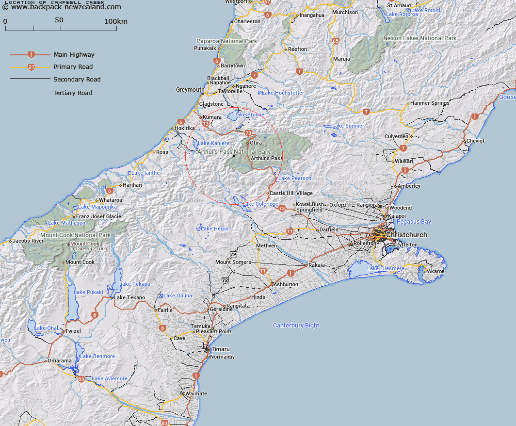
Map showing location of Campbell Creek


LINZ description: Flows into the Waimakariri River from its source near Campbell Pass. Davie Survey District.
Latitude: -42.924637
Longitude: 171.452807
Northing: 5246392.9
Easting: 1473735.7
Land District: Canterbury
Feat Type: Stream


Scroll down to see a more detailed road map and below that a topographical map showing the location of Campbell Creek. The road map has been supplied by openstreetmap and the topographical map of Campbell Creek has been supplied by Land Information New Zealand (LINZ).

Yes you can use the top static map for you school/university project or personal website with a link back. Contact me for any commercial use.

Campbell Creek Map New Zealand


New Zealand places in our database
[ A ] [ B ] [ C ] [ D ] [ E ] [ F ] [ G ] [ H ] [ I ] [ J ] [ K ] [ L ] [ M ] [ N ] [ O ] [ P ] [ Q ] [ R ] [ S ] [ T ] [ U ] [ V ] [ W ] [ X ] [ Y ] [ Z ]


Closest 20 Streams to Campbell Creek

Gorgy Creek ( 2.59km )   Mary Creek ( 2.8km )   Taipoiti River ( 3.34km )   Tumbledown Creek ( 3.5km )   Katie Creek ( 4.53km )   Julia Creek ( 4.73km )   Gold Creek ( 5km )   White River ( 5.2km )   Dexter Creek ( 5.31km )   Taipo River ( 5.78km )   Dry Creek ( 6.05km )   Harper Creek ( 7.02km )   McGrath Creek ( 7.16km )   Crow River ( 7.2km )   Micks Creek ( 7.41km )   Bealey River ( 7.46km )   Stewart Creek ( 7.72km )   Greenlaw Creek ( 7.83km )   Hanging Stream ( 7.89km )   Otira River ( 8.06km )   Doubtful Creek ( 8.3km )   Wardens Creek ( 8.41km )   Avalanche Creek ( 8.43km )   Rough Creek ( 8.44km )   Bridal Veil Creek ( 8.9km )   Hura Creek ( 8.91km )   McQuilkin Creek ( 8.98km )   Kea Creek ( 9.06km )   Curtis Creek ( 9.24km )   Cronin Stream ( 9.28km )   Pegleg Creek ( 9.33km )   Hodge Creek ( 9.33km )   Park Creek ( 9.34km )   Sphinx Creek ( 9.37km )   Rolleston River ( 9.4km )   O'Connors Creek ( 9.46km )   Snowball Creek ( 9.7km )   Starvation Point ( 9.98km )   Reid Falls ( 10.01km )   Dunns Creek ( 10.02km )