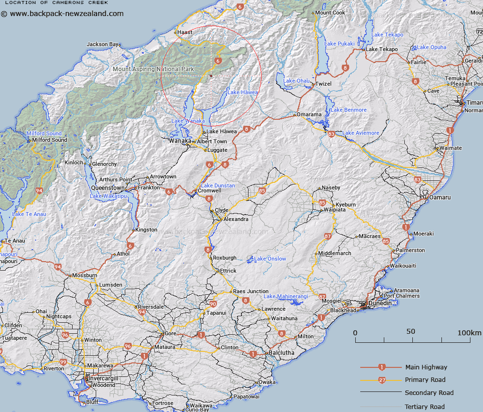
Map showing location of Camerons Creek


LINZ description: Flowing northerly from a small tarn north of Mount Shrimpton into the Makarora River. NZTopo50 BZ13-Haast Pass / Tioripatea, source: GR 035 957 to confluence: GR 039 042.
Latitude: -44.197742
Longitude: 169.316981
Northing: 5099565.1
Easting: 1305693.8
Land District: Otago
Feat Type: Stream


Scroll down to see a more detailed road map and below that a topographical map showing the location of Camerons Creek. The road map has been supplied by openstreetmap and the topographical map of Camerons Creek has been supplied by Land Information New Zealand (LINZ).

Yes you can use the top static map for you school/university project or personal website with a link back. Contact me for any commercial use.

Camerons Creek Map New Zealand


New Zealand places in our database
[ A ] [ B ] [ C ] [ D ] [ E ] [ F ] [ G ] [ H ] [ I ] [ J ] [ K ] [ L ] [ M ] [ N ] [ O ] [ P ] [ Q ] [ R ] [ S ] [ T ] [ U ] [ V ] [ W ] [ X ] [ Y ] [ Z ]


Closest 20 Streams to Camerons Creek

Templeton Creek ( 3.36km )   Muddy Creek ( 4.27km )   Brady Creek ( 4.61km )   Makarora River ( 4.77km )   Sawmill Creek ( 5.33km )   Kiwi Creek ( 5.44km )   Stewarts Creek ( 6.47km )   Pipson Creek ( 6.68km )   Cascade Creek ( 7.58km )   White Creek ( 7.59km )   Waterfall Creek ( 8.19km )   Station Creek ( 8.75km )   High Burn ( 8.81km )   Jubilee Creek ( 8.9km )   Ore Stream ( 9.19km )   Blue River South Branch ( 9.38km )   Leven Stream ( 9.48km )   Brodrick Stream ( 9.52km )   Blue River North Branch ( 9.66km )   Young River ( 10.4km )   Tiel Creek ( 10.53km )   Teal Creek ( 10.53km )   Ewings Creek ( 10.65km )   Green Gully Creek ( 11.02km )   Lake Creek ( 11.29km )   Zig Zag Creek ( 11.63km )   Fish River ( 11.8km )   Cross Creek ( 11.88km )   Boggy Creek ( 12.21km )   Cotters Creek ( 12.3km )   Gangers Creek ( 12.48km )   Blue River ( 12.71km )   Howe Creek ( 12.97km )   Big Hopwood Burn ( 13.04km )   Cemetery Creek ( 13.07km )   Wilson Creek ( 13.53km )   Fantail Creek ( 14.02km )   Jostling Water ( 14.46km )   Scrubby Flat Creek ( 14.47km )   Flaxmill Creek ( 14.52km )