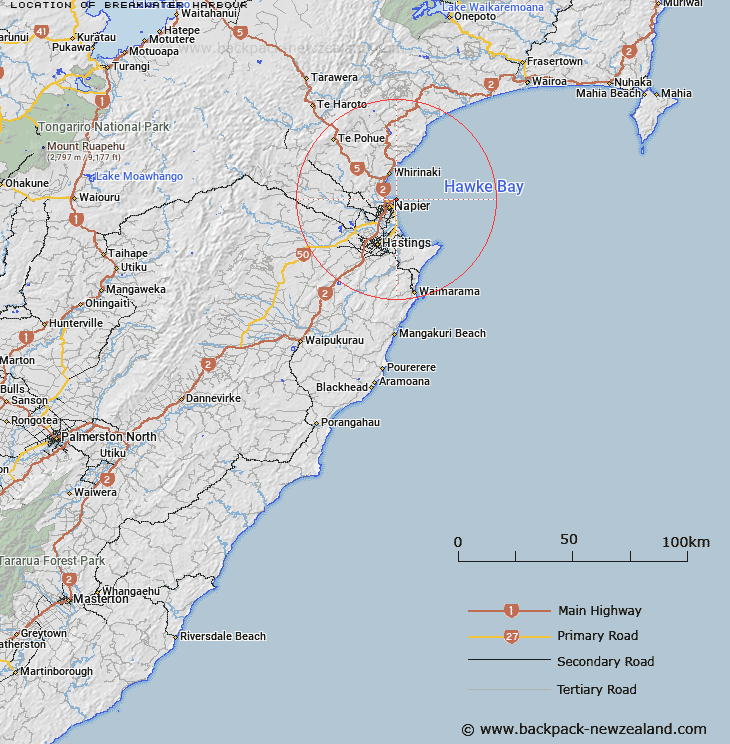
Map showing location of Breakwater Harbour


LINZ description: Manmade harbour at Port of Napier. Feature shown on Chart NZ 5612; NZTopo50-BJ39 371233
Latitude: -39.473433
Longitude: 176.919086
Northing: 5623347.5
Easting: 1937138.3
Land District: Hawke's Bay
Feat Type: Bay


Scroll down to see a more detailed road map and below that a topographical map showing the location of Breakwater Harbour. The road map has been supplied by openstreetmap and the topographical map of Breakwater Harbour has been supplied by Land Information New Zealand (LINZ).

Yes you can use the top static map for you school/university project or personal website with a link back. Contact me for any commercial use.

Breakwater Harbour Map New Zealand


New Zealand places in our database
[ A ] [ B ] [ C ] [ D ] [ E ] [ F ] [ G ] [ H ] [ I ] [ J ] [ K ] [ L ] [ M ] [ N ] [ O ] [ P ] [ Q ] [ R ] [ S ] [ T ] [ U ] [ V ] [ W ] [ X ] [ Y ] [ Z ]


Closest 20 Bays to Breakwater Harbour

Breakwater Harbour ( 0km )   Port of Napier ( 0.78km )   Iron Pot ( 2.19km )   Scapa Flow ( 2.52km )   Inner Harbour ( 3.23km )   Hawke Bay ( 4.02km )   Wairoa Bay ( 75.3km )   Te Korokoroowhaitiri Bay ( 75.57km )   Whakenepuru Bay ( 76.36km )   Paengarua Bay ( 76.47km )   Te Piripiri Bay ( 76.64km )   Sandy Bay ( 76.79km )   Onepoto Bay ( 77.08km )   Whakawakawa Bay ( 77.11km )   Te Raoa Bay ( 77.39km )   Waitio Bay ( 77.57km )   Wairaomoana (Wairau Arm) ( 77.6km )   Korotipa Bay ( 77.68km )   Rosie Bay ( 78.25km )   Ohinetekawa Bay ( 78.26km )   Maraunui Bay ( 78.43km )   Nga-Hina a te Purewa Bay ( 78.73km )   Ngahinaotepurewa Bay ( 78.73km )   Marauiti Bay ( 78.74km )   Ohinekura Bay ( 78.76km )   Te Kopua Bay ( 78.97km )   Wekaku Bay ( 79.35km )   Te Rata Bay ( 79.39km )   Papaotehiwera Bay ( 79.63km )   Te Totara Bay ( 80.04km )   Pakiwaha Bay ( 80.14km )   Whatapo Bay ( 80.29km )   Ahimanu Bay ( 80.54km )   Paraharaha Bay ( 80.69km )   Otekuri Bay ( 80.83km )   Hauotaruke Bay ( 81.55km )   Hoaitaruke Bay ( 81.55km )   Upokororo Bay ( 81.67km )   Paraeroa Bay ( 81.67km )   Rakaiaho Bay ( 82.02km )