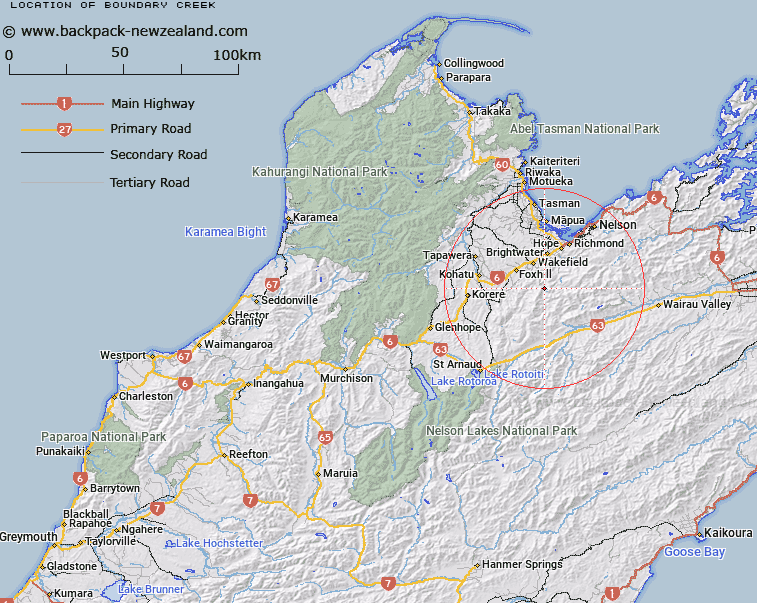
Map showing location of Boundary Creek


LINZ description: Feature shown on: NZMS260 N28 Edition 1 1987; NZTopo50-BR25 069043-BQ25 075065
Latitude: -41.500892
Longitude: 173.088371
Northing: 5405632.9
Easting: 1607375.6
Land District: Nelson
Feat Type: Stream


Scroll down to see a more detailed road map and below that a topographical map showing the location of Boundary Creek. The road map has been supplied by openstreetmap and the topographical map of Boundary Creek has been supplied by Land Information New Zealand (LINZ).

Yes you can use the top static map for you school/university project or personal website with a link back. Contact me for any commercial use.
Boundary Creek Map New Zealand


New Zealand places in our database
[ A ] [ B ] [ C ] [ D ] [ E ] [ F ] [ G ] [ H ] [ I ] [ J ] [ K ] [ L ] [ M ] [ N ] [ O ] [ P ] [ Q ] [ R ] [ S ] [ T ] [ U ] [ V ] [ W ] [ X ] [ Y ] [ Z ]


Closest 20 Streams to Boundary Creek

Boundary Creek ( 0km )   Bull Creek ( 1.7km )   Gibbs Creek ( 3.63km )   Wairoa River Right Branch ( 4.03km )   Cedar Creek ( 4.08km )   Chrome Creek ( 5.13km )   Wairoa River Left Branch ( 5.31km )   Pig Valley Stream ( 5.49km )   Anslow Creek ( 5.62km )   Big Creek ( 5.68km )   Lee River ( 7.72km )   Eighty Eight Valley Stream ( 9.06km )   Garden Valley Stream ( 9.25km )   Wairoa River ( 9.47km )   Lucy Creek ( 9.48km )   Waterfall Creek ( 9.55km )   Quail Valley Stream ( 9.86km )   Wai-iti River ( 11.74km )   Crozier Stream ( 11.91km )   Wells Creek ( 12.52km )   Wards Pass Stream ( 12.7km )   Tidd Creek ( 12.74km )   Railway Gully Stream ( 12.95km )   Baigent Valley Stream ( 13.17km )   Serpentine River ( 13.56km )   Laing Creek ( 13.56km )   Hoult Valley Stream ( 13.59km )   Toi Creek ( 13.77km )   Goulter River ( 13.95km )   Saddle Creek ( 14.4km )   Smith Gully Stream ( 14.5km )   Trass Valley Stream ( 14.8km )   Pitfure Stream ( 14.88km )   Pigeon Creek ( 15.04km )   Dun Creek ( 15.06km )   Boulder Stream ( 15.29km )   Bouldery Creek ( 15.44km )   Teapot Valley Stream ( 15.47km )   Ellis Stream ( 15.6km )   Prices Creek ( 15.94km )