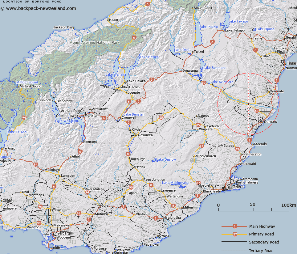
Map showing location of Bortons Pond


LINZ description: A man-made irrigation pond located on the south bank of Waitaki River near Duntroon
Latitude: -44.878913
Longitude: 170.796914
Northing: 5028139.7
Easting: 1425997.6
Land District: Otago
Feat Type: Lake


Scroll down to see a more detailed road map and below that a topographical map showing the location of Bortons Pond. The road map has been supplied by openstreetmap and the topographical map of Bortons Pond has been supplied by Land Information New Zealand (LINZ).

Yes you can use the top static map for you school/university project or personal website with a link back. Contact me for any commercial use.

Bortons Pond Map New Zealand


New Zealand places in our database
[ A ] [ B ] [ C ] [ D ] [ E ] [ F ] [ G ] [ H ] [ I ] [ J ] [ K ] [ L ] [ M ] [ N ] [ O ] [ P ] [ Q ] [ R ] [ S ] [ T ] [ U ] [ V ] [ W ] [ X ] [ Y ] [ Z ]


Closest 20 Lakes to Bortons Pond

Wainono Lagoon ( 34.58km )   Lake Waitaki ( 38.91km )   Lake Aviemore ( 48.37km )   Hoffmans Dam ( 55.11km )   Coalpit Dam ( 55.68km )   West Eweburn Dam ( 58.3km )   Lake Benmore ( 66.3km )   Washdyke Lagoon ( 67.69km )   Falls Dam ( 70.08km )   Idaburn Dam ( 72.92km )   Blue Lake ( 77.76km )   Hawksbury Lagoon ( 81.25km )   Spider Lagoon ( 84.31km )   Kellands Pond ( 86.73km )   Lake Ruataniwha ( 88.15km )   Lake Wardell ( 92.8km )   Twin Lakes ( 92.85km )   Lake Poaka ( 93.1km )   Swan Lagoon ( 93.56km )   Loch Cameron ( 93.97km )   Raupo Lagoon ( 94.27km )   Lake Merino ( 94.38km )   Salt Lake ( 95.45km )   Patersons Ponds ( 95.82km )   Poolburn Reservoir ( 95.87km )   Red Lagoon ( 96.45km )   Lake Opuha ( 99.15km )   Moa Creek Reservoir ( 99.36km )   Scott Pond ( 99.63km )   Lake Middleton ( 101.03km )   Roys Lagoon ( 101.72km )   Lake Ohau ( 103.6km )   Jimmeys Lagoon ( 103.83km )   Sullivans Dam ( 105.39km )   Trig 'N' Tarn ( 105.95km )   Phantom Lagoon ( 106.14km )   The Black Hole ( 106.66km )   Lake Alexandrina ( 107.57km )   Lake McGregor ( 107.96km )   Swan Lagoon ( 108.02km )