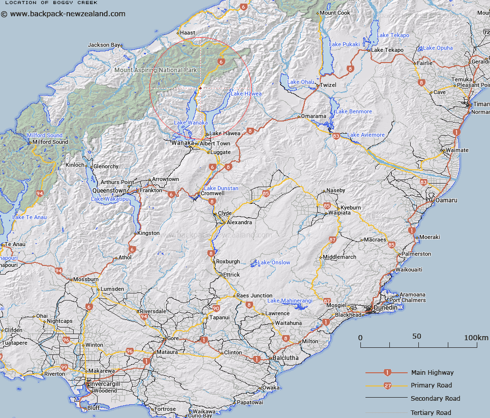
Map showing location of Boggy Creek


LINZ description: Stream flowing westward from North-west of Trig. 10721 (Geodetic Code B7V2), into the left bank of the lower reaches of Makarora River. McKerrow & Wilkin Survey Districts.
Latitude: -44.279047
Longitude: 169.213898
Northing: 5090158.9
Easting: 1297873.2
Land District: Otago
Feat Type: Stream


Scroll down to see a more detailed road map and below that a topographical map showing the location of Boggy Creek. The road map has been supplied by openstreetmap and the topographical map of Boggy Creek has been supplied by Land Information New Zealand (LINZ).

Yes you can use the top static map for you school/university project or personal website with a link back. Contact me for any commercial use.

Boggy Creek Map New Zealand


New Zealand places in our database
[ A ] [ B ] [ C ] [ D ] [ E ] [ F ] [ G ] [ H ] [ I ] [ J ] [ K ] [ L ] [ M ] [ N ] [ O ] [ P ] [ Q ] [ R ] [ S ] [ T ] [ U ] [ V ] [ W ] [ X ] [ Y ] [ Z ]


Closest 20 Streams to Boggy Creek

Cemetery Creek ( 1.07km )   Ewings Creek ( 1.93km )   Flaxmill Creek ( 2.36km )   ?turaki Creek ( 2.52km )   Station Creek ( 3.83km )   Waterfall Creek ( 4.72km )   Wharf Creek ( 4.72km )   White Creek ( 4.82km )   Tiel Creek ( 5.29km )   Teal Creek ( 5.29km )   Pipson Creek ( 5.85km )   Sawmill Creek ( 8.06km )   Boundary Creek ( 8.13km )   Young River ( 9.28km )   Brady Creek ( 9.9km )   Craigie Burn ( 10.06km )   Sheepskin Creek ( 10.88km )   Waterfall Creek ( 10.88km )   Big Hopwood Burn ( 11.05km )   Makarora River ( 11.11km )   High Burn ( 11.22km )   Templeton Creek ( 11.46km )   Leven Stream ( 11.89km )   Camerons Creek ( 12.21km )   Camp Creek ( 12.24km )   Ore Stream ( 13.15km )   Young River South Branch ( 13.27km )   Little Hopwood Burn ( 13.31km )   Rambling Burn ( 13.41km )   Muddy Creek ( 13.42km )   Fast Burn ( 13.52km )   Terrace Creek ( 13.61km )   Waterfall Creek ( 14.38km )   Terrace Creek South Branch ( 14.61km )   Young River North Branch ( 14.74km )   Blue River South Branch ( 14.85km )   Stag Creek ( 15.22km )   Bay Burn ( 15.6km )   McGregor Creek ( 15.73km )   Cascade Creek ( 15.8km )