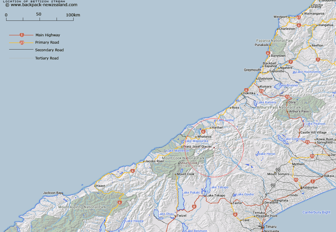
Map showing location of Bettison Stream


LINZ description: Drains the Westland side of Dennistoun Pass
Latitude: -43.39884
Longitude: 170.601893
Northing: 5192100
Easting: 1405800
Land District: Westland
Feat Type: Stream


Scroll down to see a more detailed road map and below that a topographical map showing the location of Bettison Stream. The road map has been supplied by openstreetmap and the topographical map of Bettison Stream has been supplied by Land Information New Zealand (LINZ).

Yes you can use the top static map for you school/university project or personal website with a link back. Contact me for any commercial use.

Bettison Stream Map New Zealand


New Zealand places in our database
[ A ] [ B ] [ C ] [ D ] [ E ] [ F ] [ G ] [ H ] [ I ] [ J ] [ K ] [ L ] [ M ] [ N ] [ O ] [ P ] [ Q ] [ R ] [ S ] [ T ] [ U ] [ V ] [ W ] [ X ] [ Y ] [ Z ]


Closest 20 Streams to Bettison Stream

Prospectors Creek ( 2.38km )   Scone Creek ( 3.49km )   Tainui Creek ( 3.6km )   Eric Stream ( 3.97km )   Redfield Stream ( 4.01km )   Stoeger Stream ( 4.35km )   Teichelmann Creek ( 4.67km )   Johnson Keel Stream ( 4.93km )   Julie May Stream ( 5.13km )   Elizabeth Stream ( 5.2km )   Tarn Creek ( 5.73km )   St Winifred Stream ( 5.77km )   Five Finger Stream ( 5.89km )   Adverse Creek ( 6.66km )   Havelock River ( 6.68km )   Edison Stream ( 6.79km )   Coronation Stream ( 8.04km )   Forbes River ( 8.48km )   Pauline Stream ( 8.5km )   Veil Stream ( 8.55km )   Fan Stream ( 8.57km )   Dry Creek ( 8.97km )   Perverse Creek ( 9.46km )   Barlow River ( 9.53km )   Murphy Stream ( 9.9km )   Barlow Creek ( 10.8km )   Hughes Creek ( 10.88km )   FitzGerald Stream ( 11.5km )   Emily Creek ( 11.74km )   Andrew Creek ( 11.88km )   Macaulay River ( 12.15km )   North Barlow River ( 12.4km )   Separation Stream ( 12.46km )   Tauroa Creek ( 12.47km )   The Twister ( 12.52km )   Agnes Stream ( 12.73km )   Perth River ( 12.83km )   Carneys Creek ( 13.08km )   Frances River ( 13.15km )   Harry Creek ( 13.24km )