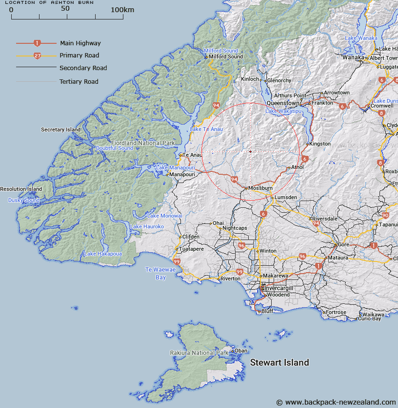
Map showing location of Ashton Burn


LINZ description: Feature shown on: NZMS260 E43 Edition 1 1992
Latitude: -45.385417
Longitude: 168.271833
Northing: 4963349.3
Easting: 1229860.3
Land District: Southland
Feat Type: Stream


Scroll down to see a more detailed road map and below that a topographical map showing the location of Ashton Burn. The road map has been supplied by openstreetmap and the topographical map of Ashton Burn has been supplied by Land Information New Zealand (LINZ).

Yes you can use the top static map for you school/university project or personal website with a link back. Contact me for any commercial use.
Ashton Burn Map New Zealand


New Zealand places in our database
[ A ] [ B ] [ C ] [ D ] [ E ] [ F ] [ G ] [ H ] [ I ] [ J ] [ K ] [ L ] [ M ] [ N ] [ O ] [ P ] [ Q ] [ R ] [ S ] [ T ] [ U ] [ V ] [ W ] [ X ] [ Y ] [ Z ]


Closest 20 Streams to Ashton Burn

Ashton Burn ( 0km )   Slaughterhouse Creek ( 6.48km )   Little Jungle Creek ( 7.78km )   Windley Creek ( 8.05km )   Bully Creek ( 8.11km )   Big Jungle Creek ( 8.34km )   Gorge Burn ( 8.72km )   Eyre Creek ( 9.31km )   Irthing Stream ( 9.34km )   Cromel Stream ( 10.37km )   Dog Box Creek ( 11.17km )   Hut Creek ( 11.42km )   Shepherd Creek ( 11.68km )   Hidden Burn ( 12.68km )   Scrubby Creek ( 13.15km )   Mataura River ( 14.1km )   Black Spur Creek ( 14.84km )   Kiwi Burn ( 14.9km )   Bushy Creek ( 14.91km )   Sandfly Creek ( 15.98km )   Windley River ( 16.86km )   Bare Creek ( 16.92km )   Jail Creek ( 16.97km )   Bush Creek ( 17.22km )   Ross Creek ( 17.71km )   Wood Burn ( 17.85km )   Wash Creek ( 18km )   White Burn ( 18.88km )   Billy Creek ( 19.15km )   Von River South Branch ( 19.57km )   Path Burn ( 19.99km )   Hayden Stream ( 20.52km )   Thomson Creek ( 20.7km )   Acton Stream ( 21.32km )   Pig Creek ( 21.59km )   Cascade Creek ( 22.41km )   West Burn ( 22.78km )   Dilston Stream ( 22.89km )   Firewood Creek ( 23.56km )   Lady Burn ( 23.74km )