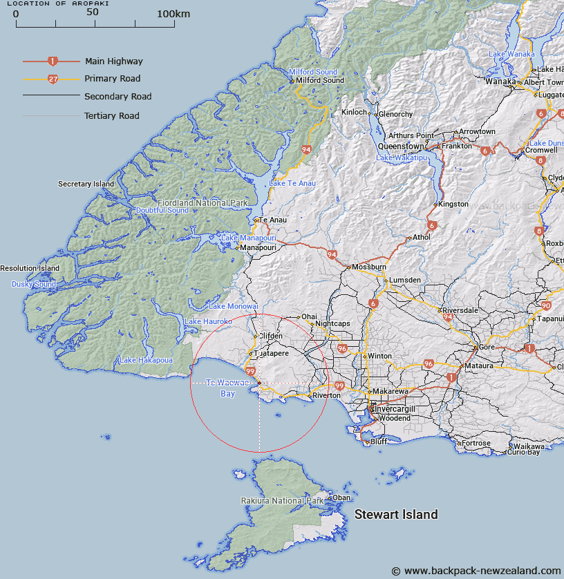
Map showing location of Aropaki
LINZ description: Locality in Te Waewae Bay, 17km South of Tuatapere and 22km North-west of Riverton. Longwood Survey District.
Latitude: -46.28263
Longitude: 167.738749
Northing: 4861082
Easting: 1194713.8
Land District: Southland
Feat Type: Locality
Latitude: -46.28263
Longitude: 167.738749
Northing: 4861082
Easting: 1194713.8
Land District: Southland
Feat Type: Locality

Scroll down to see a more detailed road map and below that a topographical map showing the location of Aropaki. The road map has been supplied by openstreetmap and the topographical map of Aropaki has been supplied by Land Information New Zealand (LINZ).
Yes you can use the top static map for you school/university project or personal website with a link back. Contact me for any commercial use.
[ A ] [ B ] [ C ] [ D ] [ E ] [ F ] [ G ] [ H ] [ I ] [ J ] [ K ] [ L ] [ M ] [ N ] [ O ] [ P ] [ Q ] [ R ] [ S ] [ T ] [ U ] [ V ] [ W ] [ X ] [ Y ] [ Z ]