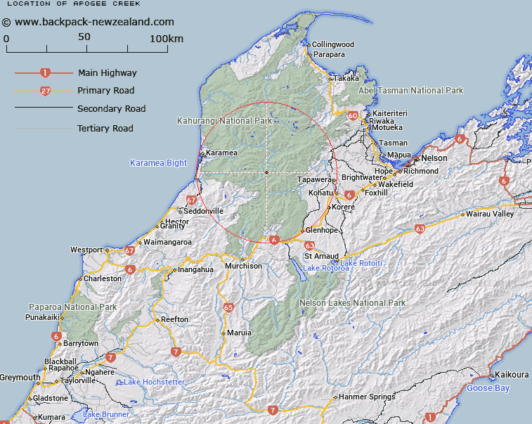
Map showing location of Apogee Creek


LINZ description: An East branch tributary of the Karamea River, joining it 1.5km above Mercury Creek. Tasman Survey District.
Latitude: -41.344981
Longitude: 172.45721
Northing: 5422803.6
Easting: 1554589.3
Land District: Nelson
Feat Type: Stream


Scroll down to see a more detailed road map and below that a topographical map showing the location of Apogee Creek. The road map has been supplied by openstreetmap and the topographical map of Apogee Creek has been supplied by Land Information New Zealand (LINZ).

Yes you can use the top static map for you school/university project or personal website with a link back. Contact me for any commercial use.

Apogee Creek Map New Zealand


New Zealand places in our database
[ A ] [ B ] [ C ] [ D ] [ E ] [ F ] [ G ] [ H ] [ I ] [ J ] [ K ] [ L ] [ M ] [ N ] [ O ] [ P ] [ Q ] [ R ] [ S ] [ T ] [ U ] [ V ] [ W ] [ X ] [ Y ] [ Z ]


Closest 20 Streams to Apogee Creek

Satellite Creek ( 1.05km )   Perigee Creek ( 1.12km )   Atlas Creek ( 1.91km )   Comet Creek ( 2.18km )   Star Creek ( 2.53km )   Sputnik Creek ( 2.66km )   Thor Creek ( 2.7km )   Mercury Creek ( 3.5km )   Mars Creek ( 3.52km )   Lunik Creek ( 3.62km )   Apollo Creek ( 4.27km )   Kinzett Stream ( 4.31km )   Hambone Creek ( 5.36km )   Crow River ( 5.56km )   Venus Creek ( 5.68km )   Orbit Creek ( 6.15km )   Meteor Creek ( 6.38km )   Saturn Creek ( 6.97km )   Taylor Stream ( 7.11km )   Jupiter Creek ( 7.14km )   Kendall Creek ( 7.19km )   Stone Creek ( 7.37km )   Luna Stream ( 8.68km )   Lost Valley Creek ( 8.83km )   Blue Duck Stream ( 9.13km )   Kiwi Stream ( 9.48km )   Little Crow River ( 10.3km )   Silvermine Creek ( 10.52km )   Herbert Creek ( 10.73km )   Wangapeka River North Branch ( 10.8km )   Slippery Creek ( 11.19km )   Patriarch Creek ( 11.23km )   Taip? River ( 11.36km )   Waters Creek ( 11.7km )   Gibbs Creek ( 12.4km )   Karamea Bend ( 12.47km )   Questa Creek ( 12.49km )   Pannikin Creek ( 13.47km )   Chummie Creek ( 13.61km )   Wright Creek ( 13.77km )