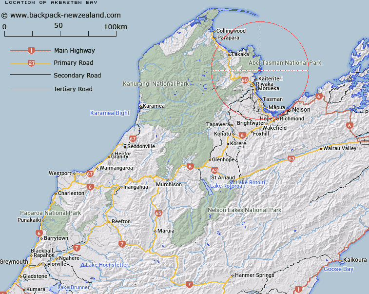
Map showing location of Akersten Bay


LINZ description: Bay immediately north of Yellow Point, Astrolabe Roadstead, Abel Tasman National Park. Block VI Kaiteriteri Survey District.
Latitude: -40.972097
Longitude: 173.048348
Northing: 5464339.3
Easting: 1604067.9
Land District: Nelson
Feat Type: Bay


Scroll down to see a more detailed road map and below that a topographical map showing the location of Akersten Bay. The road map has been supplied by openstreetmap and the topographical map of Akersten Bay has been supplied by Land Information New Zealand (LINZ).

Yes you can use the top static map for you school/university project or personal website with a link back. Contact me for any commercial use.

Akersten Bay Map New Zealand


New Zealand places in our database
[ A ] [ B ] [ C ] [ D ] [ E ] [ F ] [ G ] [ H ] [ I ] [ J ] [ K ] [ L ] [ M ] [ N ] [ O ] [ P ] [ Q ] [ R ] [ S ] [ T ] [ U ] [ V ] [ W ] [ X ] [ Y ] [ Z ]


Closest 20 Bays to Akersten Bay

Cyathea Cove ( 0.33km )   Cyathees Cove ( 0.33km )   Stilwell Bay ( 0.44km )   Watering Cove ( 1.09km )   Apple Tree Bay ( 1.45km )   Stream Cove ( 1.69km )   The Anchorage ( 2.11km )   Anchor Bay ( 2.29km )   Coquille Bay ( 2.43km )   Te Pukatea Bay ( 2.56km )   Torrent Bay ( 2.8km )   R?kauroa / Torrent Bay ( 2.8km )   Tinline Bay ( 2.8km )   Boundary Bay ( 3.66km )   Sandy Bay ( 3.97km )   Frenchman Bay ( 4.46km )   Sandfly Bay ( 5.27km )   Ot?whero Inlet ( 5.99km )   Towers Bay ( 6.04km )   Bark Bay ( 6.14km )   Ngaio Bay ( 6.44km )   Mosquito Bay ( 6.74km )   Honeymoon Bay ( 6.96km )   Breaker Bay ( 7.1km )   Kaiteriteri Inlet ( 7.98km )   Dummy Bay ( 8.76km )   Stephens Bay ( 8.95km )   Tapu Bay ( 9.19km )   Shag Harbour ( 11.24km )   Awaroa Inlet ( 12.54km )   Brereton Cove ( 12.64km )   Awaroa Bay ( 13.03km )   Canoe Bay ( 13.19km )   Waiharakeke Bay ( 14.15km )   Goat Bay ( 15.46km )   Anapai Bay ( 19.17km )   Wainui Inlet ( 19.29km )   Takapou Bay ( 19.8km )   Anatakapau Bay ( 20.46km )   Ligar Bay ( 20.73km )